Area Overview for PO10 7AQ
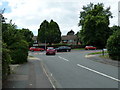
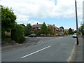
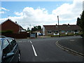
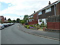
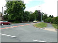
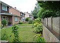
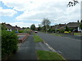
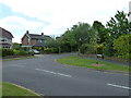
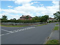
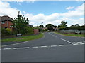
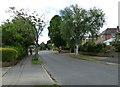
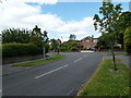
Photos of PO10 7AQ
Area Information
PO10 7AQ represents a very specific residential cluster in Hampshire, covering just 3,494 square metres of land. You will find a tightly knit community here with a population of 1,456 people concentrated in this small footprint. The high population density creates a sense of proximity, meaning neighbours are likely to know each other well. Living in PO10 7AQ offers a focused environment where daily routines revolve around a defined local sphere rather than sprawling suburbs. This postcode serves as a hub for residents seeking a compact living arrangement within the broader Emsworth vicinity. The area functions as a distinct node within the local transport and retail network, providing access to essential services without the vast distances found in larger urban zones. For someone considering this specific location, the scale is intimate, and the community feel is immediate. You are entering a space where every metre counts towards the local character.
- Area Type
- Postcode
- Area Size
- 3494 m²
- Population
- 1456
- Population Density
- 2964 people/km²
Homes in PO10 7AQ are characterised by a stock primarily composed of houses. The market is firmly established as owner-occupied, with 62% of residents owning their properties outright or with a mortgage. This high ownership rate means the area is driven by families intending to remain in the postcode long-term. You will find fewer purpose-built rental apartments compared to larger urban postcodes. The housing stock consists of residential houses that serve the needs of the predominantly adult population aged 30 to 64. Buying here typically involves purchasing a established home rather than entering an investor-led rental scheme. This structure reduces the likelihood of short-term tenancies disrupting the neighbourhood. Prospective buyers looking at PO10 7AQ should expect an environment focused on permanent residence. The physical size of the area, spanning only 3,494 square metres, means property values are influenced heavily by the immediate scarcity of space.
House Prices in PO10 7AQ
Showing 17 properties
| Address | Type | Beds | Baths | Last Sale Price | Last Sale Date | |
|---|---|---|---|---|---|---|
| 15B High Street, Emsworth, PO10 7AQ | Flat | - | - | - | - | |
| 15C High Street, Emsworth, PO10 7AQ | Flat | - | - | - | - | |
| 15A High Street, Emsworth, PO10 7AQ | Flat | - | - | - | - | |
| Emsworth Library, 23 High Street, Emsworth, PO10 7AQ | commercial | - | - | - | - | |
| Flat, 9 High Street, Emsworth, PO10 7AQ | Flat | - | - | - | - | |
| 11C High Street, Emsworth, PO10 7AQ | Flat | - | - | - | - | |
| 11B High Street, Emsworth, PO10 7AQ | Flat | - | - | - | - | |
| Emsworth Home Hardware, 11-11-A High Street, Emsworth, PO10 7AQ | shop | - | - | - | - | |
| The Emsworth Chiropody Clinic, 7A High Street, Emsworth, PO10 7AQ | Office | - | - | - | - | |
| Flat 1, International House, 21 High Street, Emsworth, PO10 7AQ | Flat | - | - | - | - |
Energy Efficiency in PO10 7AQ
Residents of PO10 7AQ enjoy direct access to a variety of retail and transport amenities within practical reach. Five railway stations, including Emsworth Railway Station, Southbourne Railway Station, and Warblington Railway Station, are nearby, providing efficient rail links. Four ferry landings, such as Bosham Hoe Ferry Landing and Hayling Island Ferry Landing, offer convenient water travel options. For shopping, you can easily reach five retail outlets, including The Southern Co-operative Co, Tesco Emsworth, and Budgens Emsworth. These venues are located close enough to form the backbone of your weekly shop. The proximity of both rail and ferry services means you have multiple transport modes without long commuting times. Dining and leisure options are integrated nearby, supported by the presence of these supermarkets and convenience stores. The variety of notes available ensures that daily errands and weekend trips can be managed with minimal travel time.
Amenities
Schools
Emsworth First School serves as the primary educational option for children living near PO10 7AQ. This institution is a primary school, catering to younger pupils before they transfer to secondary education outside this immediate vicinity. Currently, no secondary schools are listed within the direct data scope for this specific postcode area. The presence of just one named primary school indicates that families with young children will rely heavily on this single local provision. Parents must look beyond this postcode for comprehensive secondary education options. The limited school data suggests that you will need to investigate school catchment boundaries closely before making a purchase decision. Emsworth First School is the sole fixture provided for early education, and its capacity will be a key consideration. Families relocating to PO10 7AQ should verify admission policies directly with the school, as the nearby list does not indicate a variety of secondary choices.
| Rank | School | Type | Entry gender | Ages |
|---|
Explore more schools in this area
Go to Schools tabDemographics
The community within PO10 7AQ is dominated by adults aged between 30 and 64 years old. The median age for residents is 47, indicating a population settled in their life stage rather than the transient youth demographic often seen in city centres. Home ownership stands at 62%, which is a significant majority for this small postcode area. This high level of ownership suggests stability and long-term commitment to the neighbourhood. Most accommodation consists of houses, aligning with the family-oriented nature of the age profile. The predominant ethnic group is White, reflecting the demographic composition of the wider Hampshire region. You can expect a neighbourhood where generations have potentially stayed for decades. The lack of rental dominance points towards an area where families buy to stay rather than move frequently. This demographic stability often leads to consistent community engagement and established local friendships.
Household Size
Accommodation Type
Tenure
Ethnic Group
Religion
Household Composition
Age
Household Deprivation
NS-SEC
Explore more demographic insights in this area
Go to Demographics tabPlanning
Planning Constraints
- Flood RiskPremium
- Ramsar Wetland SitesPremium
- Area of Outstanding Natural BeautyPremium
- Protected Nature ReservePremium
- Protected WoodlandPremium