Area Overview for PO10 7AL
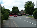
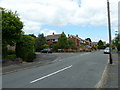
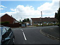
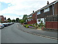
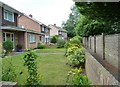
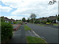
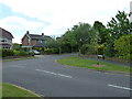
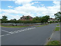
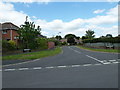
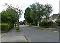
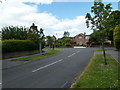
Photos of PO10 7AL

Area Information
Living in PO10 7AL offers a distinct residential experience within a very compact cluster covering just 2,101 square metres. The area accommodates a population of 1,456 people, creating a densely populated setting where neighbours are inevitably closer than in wider villages. This postcode represents a specific residential pocket where the concentration of households is intense, with the population density calculated at an extremely high figure per square kilometre. For anyone considering this location, the sheer compactness of the land defines daily life. It is an area where space is at a premium, and the environment is characterised by the proximity of homes rather than expansive green fields. The demographic profile suggests maturity, with the area predominantly occupied by adults aged between 30 and 64 years. The community here is established, favouring houses over other accommodation types. When you plan your move to PO10 7AL, you are entering a mature, owner-occupied zone with high digital connectivity and low environmental planning constraints. Understanding the physical scale of this 2,100 square metre enclave helps you appreciate the value of local amenities that lie just beyond the immediate house lines.
- Area Type
- Postcode
- Area Size
- 2101 m²
- Population
- 1456
- Population Density
- 2964 people/km²
The property market in PO10 7AL is heavily weighted towards owner-occupiers, with 62% of households owning their main residences. This statistic indicates that the local stock is dominated by people who have purchased their homes and intend to stay, rather than a landscape of short-term lets or investment properties. Accommodation types are exclusively houses, meaning you will not find flats, bungalows, or converted apartments within this specific data set. This homogeneity shapes the local market, influencing both rental demand and resale values. If you are looking at homes in PO10 7AL, expect to encounter traditional residential structures rather than modern, mixed-use developments. The limited land area of just 2,101 square metres restricts the total volume of buildable units, which naturally supports price levels based on scarcity. Despite the high population density within this small footprint, the lack of social housing or large-scale new builds suggests a static market. Buyers here are likely purchasing for stability and established neighbourhood values rather than speculative investment or rapid capital growth. This environment suits individuals prioritising bricks and mortar over flexible tenancy arrangements.
House Prices in PO10 7AL
Showing 10 properties
| Address | Type | Beds | Baths | Last Sale Price | Last Sale Date | |
|---|---|---|---|---|---|---|
| 33 High Street, Emsworth, PO10 7AL | Terraced | 2 | 1 | £264,000 | Dec 2021 | |
| 49 High Street, Emsworth, PO10 7AL | Semi-detached | - | - | £147,000 | Oct 2000 | |
| 31 High Street, Emsworth, PO10 7AL | house | - | - | £69,500 | Oct 1996 | |
| 37-37-B High Street, Emsworth, PO10 7AL | Flat | - | - | - | - | |
| Flat, 39 High Street, Emsworth, PO10 7AL | Flat | - | - | - | - | |
| 37B High Street, Emsworth, PO10 7AL | Flat | - | - | - | - | |
| 41A High Street, Emsworth, PO10 7AL | Flat | 2 | - | - | - | |
| 35A High Street, Emsworth, PO10 7AL | Flat | - | - | - | - | |
| 37A High Street, Emsworth, PO10 7AL | Maisonette | - | - | - | - | |
| Spice Village, 47 High Street, Emsworth, PO10 7AL | restaurant_cafe | - | - | - | - |
Energy Efficiency in PO10 7AL
Your daily life in PO10 7AL is centred on a cluster of accessible amenities that cover essential retail and travel needs. Within practical reach, you will find five retail outlets, specifically The Southern Co-operative Co, Tesco Emsworth, and Budgens Emsworth. These supermarkets provide all the groceries and household goods you require without needing to venture far from your home. Transport connectivity is a major asset, with five railway stations nearby including Emsworth Railway Station, Southbourne Railway Station, and Warblington Railway Station. You can also access four ferry landings such as Bosham Hoe Ferry Landing and Hayling Island Ferry Landing, offering convenient routes across the estuary. The proximity of these facilities means you have excellent variety in your weekly shopping and leisure trips. Dining options and parks are implied through the presence of local supermarkets and station vicinity services, though specific names for leisure parks or restaurants are not listed in the provided data. The Southern Co-operative Co and Tesco Emsworth anchor the local high street feel. This network of stations and shops ensures that PO10 7AL residents enjoy a lifestyle that balances suburban convenience with access to broader coastal and mainland attractions.
Amenities
Schools
Access to education in PO10 7AL is largely supported by a single primary institution within the immediate vicinity. Emsworth First School is listed as the nearest primary school. The absence of any secondary school data in the provided information means families with older children may need to travel further afield for high school education. For younger residents, the presence of Emsworth First School provides a crucial local anchor for early years learning. Commuters travelling to this school would likely rely on the nearby rail stations or road networks to reach the area from slightly wider catchments. The reliance on one named school suggests that the immediate academic options are limited to infant and junior stages. Parents moving to PO10 7AL will need to verify catchment boundaries and travel times for older pupils independently. The data does not provide Ofsted ratings or specific curriculum details, so prospective parents must conduct their own research on the school's performance metrics. However, the existence of a named primary facility confirms a dedicated educational resource is minutes away from the residential cluster.
| Rank | School | Type | Entry gender | Ages |
|---|
Explore more schools in this area
Go to Schools tabDemographics
The community within PO10 7AL is defined by a mature age structure. The median age for residents sits at 47 years, indicating a population that has settled down and perhaps moved away from rapidly changing lifestyle phases. Most commonly, the area is populated by adults ranging from 30 to 64 years of age. This steady age band often correlates with significant home ownership stability. Indeed, 62% of residents own their homes outright or have a substantial equity stake. This high ownership rate contrasts with areas dominated by private rentals or student housing. The accommodation type data confirms that houses are the predominant structure, aligning with the family-orientated age profile. Demographically, the area is chiefly populated by White British residents, contributing to a relatively homogenous community feel. The high concentration of middle-aged homeowners suggests a quiet, established neighbourhood where long-term residents tend to look out for one another. You will find fewer transient populations compared to university towns or major transport hubs. The social fabric is rooted in practicality and stability, making it an attractive option for those seeking a permanent base rather than a temporary foothold.
Household Size
Accommodation Type
Tenure
Ethnic Group
Religion
Household Composition
Age
Household Deprivation
NS-SEC
Explore more demographic insights in this area
Go to Demographics tabPlanning
Planning Constraints
- Flood RiskPremium
- Ramsar Wetland SitesPremium
- Area of Outstanding Natural BeautyPremium
- Protected Nature ReservePremium
- Protected WoodlandPremium