Area Overview for OX7 5TN
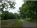
Photos of OX7 5TN


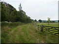


![Park Farm [1] in OX7 5TN](https://images.propbar.co.uk/images/geograph/24/38/2438177_120.jpg)
![Park Farm [2] in OX7 5TN](https://images.propbar.co.uk/images/geograph/24/38/2438181_120.jpg)

24 photos from this area
Area Information
Key information about the OX7 5TN including its size, population, and administrative classification.
- Area Type
- Postcode
- Area Size
- 15.2 hectares
- Population
- 1623
- Population Density
- 29 people/km²
House Prices in OX7 5TN
8
Properties
£770,000
Average Sold Price
£310,000
Lowest Price
£1,000,000
Highest Price
Showing 8 properties
| Address | Type | Beds | Baths | Last Sale Price | Last Sale Date | |
|---|---|---|---|---|---|---|
| Old School House, Street Through Heythrop, Heythrop, Chipping Norton, OX7 5TN | house | - | - | £1,000,000 | Mar 2014 | |
| Corner House, Street Through Heythrop, Heythrop, Chipping Norton, OX7 5TN | Detached | 4 | 3 | £1,000,000 | Feb 2012 | |
| Shepherds House, Street Through Heythrop, Heythrop, Chipping Norton, OX7 5TN | house | 2 | - | £310,000 | Aug 2006 | |
| North Wing, The Old School, Street Through Heythrop, Heythrop, Chipping Norton, OX7 5TN | undefined | - | - | - | - | |
| Grove End House, Street Through Heythrop, Heythrop, Chipping Norton, OX7 5TN | Terraced | - | - | - | - | |
| Annexe, Grove End, Street Through Heythrop, Heythrop, Chipping Norton, OX7 5TN | house | - | - | - | - | |
| The Studio, Grove End, Street Through Heythrop, Heythrop, Chipping Norton, OX7 5TN | Bungalow | 1 | - | - | - | |
| Annexe At, Old School House, Street Through Heythrop, Heythrop, Chipping Norton, OX7 5TN | Flat | - | - | - | - |
Energy Efficiency in OX7 5TN
Amenities
Schools
| Rank | School | Type | Entry gender | Ages |
|---|
Explore more schools in this area
Go to Schools tabDemographics
Household Size
Two person
most common
Accommodation Type
Houses
most common
Tenure
69
majority
Ethnic Group
White
most common
Religion
N/A
most common
Household Composition
N/A
most common
Age
47
median
Adults (30-64 years)
most common
Household Deprivation
N/A
with no deprivation
NS-SEC
43
in Lower managerial occupations
Explore more demographic insights in this area
Go to Demographics tabPlanning
Planning Constraints
- Flood RiskPremium
- Ramsar Wetland SitesPremium
- Area of Outstanding Natural BeautyPremium
- Protected Nature ReservePremium
- Protected WoodlandPremium