Area Overview for OX7 5QH
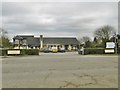
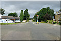
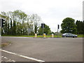
Photos of OX7 5QH


Area Information
Living in OX7 5QH offers a defined residential experience within a cluster covering 1.2 square kilometres. The postcode serves a specific population of 2,280 people across this compact footprint. You will find a tight-knit community where daily life revolves around a high density of 450 people per square kilometre. This sizeable residential area balances space with convenience, ensuring that essentials are rarely far away. The environment caters primarily to adults, with the core demographic falling between 30 and 64 years old. This age profile suggests a stable community where families and empty nesters have established roots. The concentration of homes means you walk through neighbourhoods filled with long-term residents rather than transient occupiers. The layout supports a quiet yet accessible existence without the sprawl of larger towns.
- Area Type
- Postcode
- Area Size
- 1.2 km²
- Population
- 2280
- Population Density
- 450 people/km²
The housing stock in OX7 5QH is almost entirely composed of houses, creating a distinct property market focused on detached or semi-detached homes. This accommodation type aligns perfectly with the 72% home ownership rate, meaning the area is predominantly owner-occupied. You will find few if any rental conversions or smaller flats available for purchase within this specific cluster. The nature of the homes as houses rather than apartments dictates the lifestyle and valuation potential for buyers. With such a high proportion of owners, tenants looking for homes in OX7 5QH may face limited choices within this precise postcode. The market reflects a desire for privacy and space rather than a dense urban living situation. Prospective buyers should note that inventory will consist mainly of single-family dwellings. This structure offers advantages regarding ground-floor access and outdoor space. Potential buyers must be prepared for a market driven by family homes and retirement properties rather than student accommodation.
House Prices in OX7 5QH
Showing 13 properties
Energy Efficiency in OX7 5QH
Daily life in OX7 5QH benefits from the immediate proximity of several key amenities. You have access to five notable retail outlets including Waitrose Little, M&S, and Aldi Chipping. These stores provide essential shopping needs for Groceries, clothing, and household goods without a long journey. Three railway stations serve the transport links: Charlbury Railway Station, Ascott, and Kingham Railway Station. This network offers practical rail access to wider parts of Oxfordshire and beyond. Shopping trips at Waitrose Little or M&S fit easily into a routine schedule. Commuting by train from Ascott or Kingham provides a manageable travel time. The concentration of five retail units means you rarely need to leave the immediate neighbourhood for daily errands. Public transport options at the three stations give you flexibility for travel days without a car. This blend of local convenience and national rail access defines the practical lifestyle for homeowners in this postcode.
Amenities
Schools
Families considering OX7 5QH will find Holy Trinity Catholic School, Chipping Norton within practical reach. This establishment operates as both a primary and an academy and holds an outstanding Ofsted rating. This dual operation provides comprehensive education from early years through to secondary levels in one location. The presence of Holy Trinity Catholic School, Chipping Norton offers a Catholic ethos alongside high academic standards. Nearby, Park School provides special education services and also carries a good Ofsted rating. This combination ensures that specific educational needs are met alongside general curriculum requirements. You have access to institutions with proven records of success as indicated by their Ofsted designations. The proximity of these two distinct schools means families do not need to travel extensively for education. The mix of primary and special provision schools suggests a supportive local network for children. These establishments form the backbone of educational opportunities for residents of this area.
| Rank | School | Type | Entry gender | Ages |
|---|
Explore more schools in this area
Go to Schools tabDemographics
The community in OX7 5QH is characterised by a predominantly adult population where most residents are aged between 30 and 64 years. The median age stands at 47, confirming that this is a mature sector away from young professionals or students. House ownership is a dominant feature of the local society, with 72% of households owned outright or with a mortgage. This high rate of ownership implies a stable demographic with a strong investment in the local infrastructure. The predominant ethnic group identifies as White, reflecting a homogenous social fabric. Accommodation types are almost exclusively houses, indicating a lack of high-rise blocks or purpose-built flats in the immediate vicinity. This scarcity of larger rental blocks aligns with the high ownership figure. The data shows no significant indicators of deprivation affecting the quality of life in this cluster. Families and individuals value stability here, securing their homes against market fluctuations. You are buying into a settled environment where change is gradual.
Household Size
Accommodation Type
Tenure
Ethnic Group
Religion
Household Composition
Age
Household Deprivation
NS-SEC
Explore more demographic insights in this area
Go to Demographics tabPlanning
Planning Constraints
- Flood RiskPremium
- Ramsar Wetland SitesPremium
- Area of Outstanding Natural BeautyPremium
- Protected Nature ReservePremium
- Protected WoodlandPremium