Area Overview for OX7 5BE
Photos of OX7 5BE


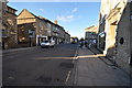
![Footpath to Over Norton [1] in OX7 5BE](https://images.propbar.co.uk/images/geograph/19/57/1957687_120.jpg)


100 photos from this area
Area Information
Key information about the OX7 5BE including its size, population, and administrative classification.
- Area Type
- Postcode
- Area Size
- 1.7 hectares
- Population
- 1585
- Population Density
- 3239 people/km²
House Prices in OX7 5BE
42
Properties
£194,291
Average Sold Price
£56,000
Lowest Price
£395,250
Highest Price
Showing 42 properties
| Address | Type | Beds | Baths | Last Sale Price | Last Sale Date | |
|---|---|---|---|---|---|---|
| 12 Shepard Way, Chipping Norton, OX7 5BE | Bungalow | 1 | 1 | £215,000 | Oct 2025 | |
| 15 Shepard Way, Chipping Norton, OX7 5BE | Flat | 3 | - | £315,000 | May 2025 | |
| 33 Shepard Way, Chipping Norton, OX7 5BE | Bungalow | 2 | 1 | £199,995 | Jan 2025 | |
| 6 Shepard Way, Chipping Norton, OX7 5BE | Semi-detached | 3 | 1 | £305,000 | Jan 2025 | |
| 30 Shepard Way, Chipping Norton, OX7 5BE | Bungalow | 2 | 1 | £160,000 | Dec 2024 | |
| 34 Shepard Way, Chipping Norton, OX7 5BE | Bungalow | 2 | 1 | £179,950 | Aug 2024 | |
| 19 Shepard Way, Chipping Norton, OX7 5BE | Semi-detached | 2 | 1 | £198,000 | May 2024 | |
| 42 Shepard Way, Chipping Norton, OX7 5BE | Semi-detached | 2 | 1 | £182,500 | Dec 2023 | |
| 38 Shepard Way, Chipping Norton, OX7 5BE | Bungalow | 2 | 1 | £190,000 | Dec 2023 | |
| 9 Shepard Way, Chipping Norton, OX7 5BE | Flat | - | - | £340,000 | Nov 2023 |
Page 1 of 5
Energy Efficiency in OX7 5BE
Amenities
Schools
| Rank | School | Type | Entry gender | Ages |
|---|
Explore more schools in this area
Go to Schools tabDemographics
Household Size
One person
most common
Accommodation Type
Houses
most common
Tenure
62
majority
Ethnic Group
White
most common
Religion
N/A
most common
Household Composition
N/A
most common
Age
47
median
Adults (30-64 years)
most common
Household Deprivation
N/A
with no deprivation
NS-SEC
39
in Lower managerial occupations
Explore more demographic insights in this area
Go to Demographics tabPlanning
Planning Constraints
- Flood RiskPremium
- Ramsar Wetland SitesPremium
- Area of Outstanding Natural BeautyPremium
- Protected Nature ReservePremium
- Protected WoodlandPremium