Area Overview for OX7 5BJ
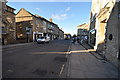
Photos of OX7 5BJ


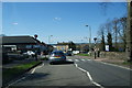


![Footpath to Over Norton [1] in OX7 5BJ](https://images.propbar.co.uk/images/geograph/19/57/1957687_120.jpg)
Area Information
OX7 5BJ is a small, dense residential cluster situated within the OX7 postcode sector in England. This specific area spans only 1.5 hectares, yet it houses a population of 1,585 people. You are looking at a community with a very high population density of 107,947 people per square kilometre. Living in OX7 5BJ means residing in a tightly packed environment where neighbours are likely close by. The area serves as a contained residential zone rather than a sprawling suburb. Its size dictates a focus on immediate local interactions and efficient access to nearby services. Daily life here is defined by a compact footprint and a strong sense of locality. Residents benefit from proximity to the surrounding towns that share the broader OX7 designation. The distinct character of this postcode is shaped by its low physical spread and high urban intensity. You will find that this cluster offers convenience alongside a lived-in, established neighbourhood atmosphere.
- Area Type
- Postcode
- Area Size
- 1.5 hectares
- Population
- 1585
- Population Density
- 3239 people/km²
Homes in OX7 5BJ are primarily houses, with 62% of the population owning their property. This high rate of home ownership signals a market where people have a significant stake in their local environment. The stock consists predominantly of houses rather than flats or terraced apartments, offering more space and independence for residents. Living in this area typically means purchasing a standalone home or a house in a small courtyard. The 62% ownership figure contrasts with areas where rental properties dominate, suggesting investors are less prevalent here. Buyers looking at this small cluster should anticipate a market driven by owner-occupiers seeking stability. The nature of the housing stock aligns with the demographic profile of adults in their most productive working years. You will likely encounter properties built to suit families and those planning to retire locally. The mix of owner-occupied houses creates a predictable and stable property environment for you as a potential buyer.
House Prices in OX7 5BJ
Showing 38 properties
| Address | Type | Beds | Baths | Last Sale Price | Last Sale Date | |
|---|---|---|---|---|---|---|
| 26 Albion Street, Chipping Norton, OX7 5BJ | house | 3 | - | £376,500 | Feb 2022 | |
| 24 Albion Street, Chipping Norton, OX7 5BJ | house | - | - | £330,000 | Sep 2021 | |
| The Old Coach House, 18C Albion Street, Chipping Norton, OX7 5BJ | Terraced | 2 | 1 | £315,000 | Sep 2020 | |
| 28A Albion Street, Chipping Norton, OX7 5BJ | Semi-detached | 2 | 1 | £145,000 | Dec 2019 | |
| 20 Albion Street, Chipping Norton, OX7 5BJ | Semi-detached | 3 | 1 | £363,750 | May 2017 | |
| 6C Albion Street, Chipping Norton, OX7 5BJ | house | - | - | £252,000 | Apr 2017 | |
| 6 Albion Street, Chipping Norton, OX7 5BJ | house | 3 | - | £260,000 | Oct 2016 | |
| 4A Albion Street, Chipping Norton, OX7 5BJ | Semi-detached | 2 | - | £190,000 | Mar 2016 | |
| 2D Albion Street, Chipping Norton, OX7 5BJ | Flat | 2 | 1 | £169,000 | Mar 2016 | |
| 2A Albion Street, Chipping Norton, OX7 5BJ | Flat | - | - | £175,000 | Jun 2015 |
Energy Efficiency in OX7 5BJ
Residents of OX7 5BJ have practical access to five retail outlets within easy reach. You can visit Co-op Chipping, Sainsburys Chipping, and M&S for your daily shopping requirements. The area also benefits from four railway stations serving its commuting needs. Nearby stations include Kingham Railway Station, Ascott, and Charlbury Railway Station. These transport links allow easy travel to wider Oxfordshire towns for leisure or work. The combination of local supermarkets and rail access simplifies your weekly routine. Daily life involves a short trip to the shops and a straightforward commute by train. Specific venues like Sainsburys Chipping mean you do not need to travel far for essentials. The retail and rail infrastructure supports a balanced lifestyle where convenience meets wider connectivity. Residents enjoy the practicality of having major chains and rail hubs immediately accessible.
Amenities
Schools
Living in OX7 5BJ places you near a specific mix of educational institutions. The ACE Centre Nursery School serves as a starting point for early education. Chipping Norton County Infant School provides primary education for younger children. For secondary education, Chipping Norton School Academy operates as a school with an outstanding Ofsted rating. This academy offers high-quality education and stands out for its performance. Penhurst School serves as a special school, catering to specific educational needs. The proximity to Chipping Norton School Academy means families benefit from a top-tier option nearby. The presence of an outstanding-rated academy is a significant advantage for parents considering OX7 5BJ. You have access to a nursery, infant school, and a secondary academy all within practical reach. Schools near OX7 5BJ cover the full range from earliest years through to secondary schooling. The inclusion of a special school indicates a comprehensive community approach to education.
| Rank | School | Type | Entry gender | Ages |
|---|
Explore more schools in this area
Go to Schools tabDemographics
The community within OX7 5BJ is dominated by older adults. The median age is 47 years, and the most common age range comprises adults between 30 and 64 years old. This age profile suggests an area largely populated by individuals in their working years and established families. Home ownership stands at 62%, indicating that the majority of residents own their properties outright or with a mortgage. Most homes in OX7 5BJ are houses, reinforcing the suburban or semi-rural feel of the cluster despite its high density. The predominant ethnic group is White, reflecting a primarily homogeneous population structure. You can expect a stable community where established residents have lived for some time. The high home ownership rate points towards a settled demographic rather than a transient rental market. These figures describe a neighbourhood where long-term residence is the norm. Life in this area is characterised by stability and a mature resident base.
Household Size
Accommodation Type
Tenure
Ethnic Group
Religion
Household Composition
Age
Household Deprivation
NS-SEC
Explore more demographic insights in this area
Go to Demographics tabPlanning
Planning Constraints
- Flood RiskPremium
- Ramsar Wetland SitesPremium
- Area of Outstanding Natural BeautyPremium
- Protected Nature ReservePremium
- Protected WoodlandPremium