Area Overview for OX7 4LF
Photos of OX7 4LF


Area Information
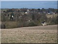
The OX7 4LF postcode defines a specific residential cluster within England, covering an area of just 9,313 square metres. This compact footprint supports a small population of 1,242 people, creating a tightly knit community rather than a sprawling suburb. Residents here experience a distinct neighbourhood character, shaped by the fact that the entire population fits within such a limited geographical boundary. Living in OX7 4LF means being part of a settlement where every resident is a neighbour, fostering a strong sense of local identity and mutual awareness. The area sits amongst the Adults age group, which dominates the demographic profile between 30 and 64 years old. This concentration of mature adults suggests a settled, stable community where long-term residents have established deep roots. Daily life in this small area involves a close connection to the immediate surroundings, with access to nearby towns like Charlbury and Little Broughton for wider services. The density here is relatively low, sitting at 52 people per square kilometre, which provides a peaceful environment while maintaining community cohesion. Prospective buyers considering homes in OX7 4LF are entering a market defined by its size and the specific lifestyle it offers to those seeking a quieter, local-focused existence in the Oxfordshire region.
- Area Type
- Postcode
- Area Size
- 9313 m²
- Population
- 1242
- Population Density
- 52 people/km²
Buying a home in OX7 4LF offers a specific profile for those seeking established residential property. The market here is overwhelmingly owner-occupied, with 72% of the accommodation held by people who have purchased their homes. This statistic clearly marks the area as an owner-led community rather than a private rental sector. Accommodation types are strictly Houses, meaning you will not find any apartments or flats within this specific postcode boundary. This exclusivity to houses suggests a traditional suburban or village housing stock, likely comprising detached or semi-detached properties suited to families. The small total area of 9,313 square metres implies a limited supply of new listings, reinforcing the sense of a closed, exclusive market. For buyers looking at homes in OX7 4LF, the high ownership rate suggests strong property values and a community of people invested in their addresses. This is not a student quarter or a development zone but a place where families buy to live. The absence of flats further narrows the options to house buyers specifically. Those navigating the property market should expect a focus on established dwellings rather than modern blocks of flats. The 72% ownership figure is a key indicator for anyone assessing whether this location fits their long-term property goals.
House Prices in OX7 4LF
Showing 12 properties
| Address | Type | Beds | Baths | Last Sale Price | Last Sale Date | |
|---|---|---|---|---|---|---|
| Dormers, Coxs Lane, Enstone, OX7 4LF | Detached | 4 | 1 | £472,500 | Aug 2025 | |
| Rowston Cottage, Coxs Lane, Enstone, OX7 4LF | house | - | - | £482,000 | Mar 2018 | |
| The Gables, Coxs Lane, Enstone, OX7 4LF | Detached | - | - | £249,950 | May 2000 | |
| Annexe, The Red House, Coxs Lane, Enstone, OX7 4LF | Flat | - | - | - | - | |
| Staff Accommodation, Enstone House, Coxs Lane, Enstone, OX7 4LF | commercial | - | - | - | - | |
| Mendoza, Coxs Lane, Enstone, OX7 4LF | Detached | - | - | - | - | |
| Ash House, Coxs Lane, Enstone, OX7 4LF | Terraced | - | - | - | - | |
| The Red House, Coxs Lane, Enstone, OX7 4LF | Detached | - | - | - | - | |
| Hope Fold, Coxs Lane, Enstone, OX7 4LF | Detached | - | - | - | - | |
| Talbot Cottage, Coxs Lane, Enstone, OX7 4LF | house | - | - | - | - |
Energy Efficiency in OX7 4LF
Lifestyle in OX7 4LF is supported by a range of amenities within practical reach, offering convenience without the need for long drives. Retail choices number five in the vicinity, including well-known chains such as Co-op Charlbury, Waitrose Little, and M&S. These locations provide everything from supermarkets to daily essentials, ensuring you can handle most shopping needs nearby. Transport links are equally accessible, with four rail stations situated close by, specifically Charlbury Railway Station, Finstock Railway Station, and Ascott. These stations offer direct connections to wider Oxfordshire and beyond. The presence of этих specific retailers means you do not need to travel far for groceries or household goods. Living in OX7 4LF blends the quiet of a residential postcode with the convenience of established town centres like Charlbury and Little. You can enjoy a morning coffee at a local spot or stock up on groceries at Waitrose Little with minimal effort. The variety of amenities suggests a balanced lifestyle where daily errands are manageable. Train travel via Charlbury or Finstock further extends your options for weekends away or work commutes. This mix of retail and rail access defines the everyday experience for residents of this postcode area.
Amenities
Schools
For families considering OX7 4LF, education options begin with Enstone Primary School, located within practical reach of the postcode. This institution operates as a primary school and currently holds a 'good' Ofsted rating. The presence of a rated primary school suggests that local children receive solid education before potentially moving to secondary institutions in nearby towns like Enstone or Charlbury. While there are no secondary schools or special institutions listed directly within the immediate data set for OX7 4LF, the proximity of Enstone Primary provides a comfortable first. Parents driving to Enstone Primary School will be well-supported by the school's positive rating, which indicates a standard of teaching and environment that meets the government's criteria for quality. The mix of school types available is simply primary-focused at this specific radius, meaning older children likely commute further for their education. Living in OX7 4LF places your children within manageable distance of a reputable primary facility. If you are evaluating schools to find schools near OX7 4LF, Enstone Primary School is the immediate candidate. The 'good' rating provides reassurance regarding the educational foundation your child will receive in the early years.
| Rank | School | Type | Entry gender | Ages |
|---|
Explore more schools in this area
Go to Schools tabDemographics
The community in OX7 4LF is defined by a mature demographic profile, with a median age of 47 years. Adults between the ages of 30 and 64 represent the most common age range, indicating a population dominated by working-age individuals and established families. House ownership stands at an impressive 72%, confirming that this is primarily a homeowner area rather than a rental hotspot. This high rate of ownership aligns with the accommodation type, which is exclusively Houses. You will find numerous detached or semi-detached residences suitable for families looking to settle down. The predominant ethnic group recorded in the area is White, reflecting the traditional demographic makeup of many rural and semi-rural settlements in Oxfordshire. For those interested in the background context, the lack of significant variation in household types or rapid demographic shifts suggests a stable, long-term community. The high proportion of homeowners indicates that many residents plan to stay in this location for the foreseeable future. This stability often translates into quieter streets and established neighbourhood ties. When looking at OX7 4LF, you are observing a community where the majority of residents have purchased their homes and likely have families or extended families nearby. The demographic data paints a picture of a established neighbourhood where people are rooted in the area.
Household Size
Accommodation Type
Tenure
Ethnic Group
Religion
Household Composition
Age
Household Deprivation
NS-SEC
Explore more demographic insights in this area
Go to Demographics tabPlanning
Planning Constraints
- Flood RiskPremium
- Ramsar Wetland SitesPremium
- Area of Outstanding Natural BeautyPremium
- Protected Nature ReservePremium
- Protected WoodlandPremium