Area Overview for OX7 4LD
Photos of OX7 4LD

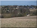


85 photos from this area
Area Information
Key information about the OX7 4LD including its size, population, and administrative classification.
- Area Type
- Postcode
- Area Size
- 2.1 hectares
- Population
- 1242
- Population Density
- 52 people/km²
House Prices in OX7 4LD
23
Properties
£348,700
Average Sold Price
£40,000
Lowest Price
£690,000
Highest Price
Showing 23 properties
| Address | Type | Beds | Baths | Last Sale Price | Last Sale Date | |
|---|---|---|---|---|---|---|
| 5 The Spinneys, Enstone, OX7 4LD | Detached | 4 | 1 | £690,000 | Aug 2024 | |
| 10 The Spinneys, Enstone, OX7 4LD | Semi-detached | 3 | 1 | £375,000 | Sep 2020 | |
| 16 The Spinneys, Enstone, OX7 4LD | Detached | 5 | 2 | £580,000 | Feb 2017 | |
| 1 The Spinneys, Enstone, OX7 4LD | Detached | 3 | 3 | £455,000 | Mar 2016 | |
| 14 The Spinneys, Enstone, OX7 4LD | Detached | 4 | 2 | £487,500 | Jan 2016 | |
| 22 The Spinneys, Enstone, OX7 4LD | Detached | - | - | £249,999 | Nov 2004 | |
| 17 The Spinneys, Enstone, OX7 4LD | Detached | - | - | £270,000 | Aug 2004 | |
| 4 The Spinneys, Enstone, OX7 4LD | house | - | - | £230,000 | Nov 2001 | |
| 18 The Spinneys, Enstone, OX7 4LD | house | - | - | £40,000 | Feb 1998 | |
| 20 The Spinneys, Enstone, OX7 4LD | Detached | - | - | £109,500 | Mar 1997 |
Page 1 of 3
Energy Efficiency in OX7 4LD
Amenities
Schools
| Rank | School | Type | Entry gender | Ages |
|---|
Explore more schools in this area
Go to Schools tabDemographics
Household Size
Two person
most common
Accommodation Type
Houses
most common
Tenure
72
majority
Ethnic Group
White
most common
Religion
N/A
most common
Household Composition
N/A
most common
Age
47
median
Adults (30-64 years)
most common
Household Deprivation
N/A
with no deprivation
NS-SEC
41
in Lower managerial occupations
Explore more demographic insights in this area
Go to Demographics tabPlanning
Planning Constraints
- Flood RiskPremium
- Ramsar Wetland SitesPremium
- Area of Outstanding Natural BeautyPremium
- Protected Nature ReservePremium
- Protected WoodlandPremium