Area Overview for OX5 2SY
Photos of OX5 2SY

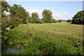
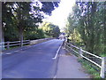
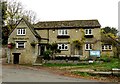
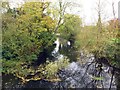
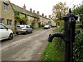
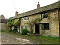
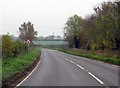
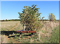
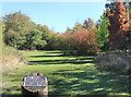
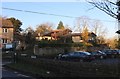
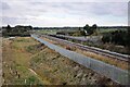
44 photos from this area
Area Information
Key information about the OX5 2SY including its size, population, and administrative classification.
- Area Type
- Postcode
- Area Size
- 14.4 hectares
- Population
- 1227
- Population Density
- 80 people/km²
House Prices in OX5 2SY
21
Properties
£1,119,369
Average Sold Price
£175,000
Lowest Price
£3,150,000
Highest Price
Showing 21 properties
| Address | Type | Beds | Baths | Last Sale Price | Last Sale Date | |
|---|---|---|---|---|---|---|
| The Grange, Mill Street, Islip, OX5 2SY | house | - | - | £3,150,000 | May 2024 | |
| Ray Cottage, Mill Street, Islip, OX5 2SY | Detached | 5 | 4 | £1,400,000 | Mar 2019 | |
| Curtesy House, Mill Street, Islip, OX5 2SY | Detached | 5 | 4 | £1,460,000 | Aug 2018 | |
| Cotswold House, Mill Street, Islip, OX5 2SY | house | - | - | £1,045,000 | Jun 2015 | |
| The Old Barn, Mill Street, Islip, OX5 2SY | Detached | 3 | - | £860,000 | Aug 2014 | |
| 14 Mill Street, Islip, OX5 2SY | Detached | 3 | 3 | £249,950 | Oct 2002 | |
| Prospect House, Mill Street, Islip, OX5 2SY | Detached | - | - | £615,000 | Jul 2001 | |
| Humphrey Cottage, Mill Street, Islip, OX5 2SY | Terraced | - | - | £175,000 | Dec 2000 | |
| Bank Cottage, Mill Street, Islip, OX5 2SY | Semi-detached | 2 | - | - | - | |
| Forsyte Cottage And 14, Mill Street, Islip, OX5 2SY | Terraced | - | - | - | - |
Page 1 of 3
Energy Efficiency in OX5 2SY
Amenities
Schools
| Rank | School | Type | Entry gender | Ages |
|---|
Explore more schools in this area
Go to Schools tabDemographics
Household Size
Two person
most common
Accommodation Type
Houses
most common
Tenure
82
majority
Ethnic Group
White
most common
Religion
N/A
most common
Household Composition
N/A
most common
Age
47
median
Adults (30-64 years)
most common
Household Deprivation
N/A
with no deprivation
NS-SEC
52
in Lower managerial occupations
Explore more demographic insights in this area
Go to Demographics tabPlanning
Planning Constraints
- Flood RiskPremium
- Ramsar Wetland SitesPremium
- Area of Outstanding Natural BeautyPremium
- Protected Nature ReservePremium
- Protected WoodlandPremium