Area Overview for OX5 2BU
Photos of OX5 2BU
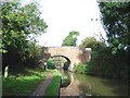
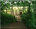
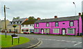
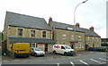
72 photos from this area
Area Information
Key information about the OX5 2BU including its size, population, and administrative classification.
- Area Type
- Postcode
- Area Size
- 1.5 hectares
- Population
- 1287
- Population Density
- 1255 people/km²
House Prices in OX5 2BU
40
Properties
£227,494
Average Sold Price
£63,000
Lowest Price
£420,000
Highest Price
Showing 40 properties
| Address | Type | Beds | Baths | Last Sale Price | Last Sale Date | |
|---|---|---|---|---|---|---|
| 72 Banbury Road, Kidlington, OX5 2BU | Bungalow | 6 | 3 | £249,950 | Jan 2017 | |
| 52 Banbury Road, Kidlington, OX5 2BU | house | 3 | 1 | £420,000 | May 2016 | |
| 54 Banbury Road, Kidlington, OX5 2BU | house | 5 | 1 | £345,000 | May 2010 | |
| 56 Banbury Road, Kidlington, OX5 2BU | Terraced | - | - | £238,000 | Aug 2006 | |
| 78 Banbury Road, Kidlington, OX5 2BU | Semi-detached | - | - | £228,000 | Aug 2002 | |
| 58 Banbury Road, Kidlington, OX5 2BU | Terraced | - | - | £166,000 | Aug 2000 | |
| 64 Banbury Road, Kidlington, OX5 2BU | Detached | - | - | £110,000 | Aug 1998 | |
| 80 Banbury Road, Kidlington, OX5 2BU | Semi-detached | - | - | £63,000 | Jul 1995 | |
| Flat 5, 50 Banbury Road, Kidlington, OX5 2BU | Flat | 2 | 1 | - | - | |
| Flat 3, 44 Banbury Road, Kidlington, OX5 2BU | Flat | 2 | 2 | - | - |
Page 1 of 4
Energy Efficiency in OX5 2BU
Amenities
Schools
| Rank | School | Type | Entry gender | Ages |
|---|
Explore more schools in this area
Go to Schools tabDemographics
Household Size
Family (3-5 people)
most common
Accommodation Type
Houses
most common
Tenure
72
majority
Ethnic Group
White
most common
Religion
N/A
most common
Household Composition
N/A
most common
Age
47
median
Adults (30-64 years)
most common
Household Deprivation
N/A
with no deprivation
NS-SEC
34
in Lower managerial occupations
Explore more demographic insights in this area
Go to Demographics tabPlanning
Planning Constraints
- Flood RiskPremium
- Ramsar Wetland SitesPremium
- Area of Outstanding Natural BeautyPremium
- Protected Nature ReservePremium
- Protected WoodlandPremium