Area Overview for OX5 2AT
Photos of OX5 2AT
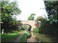
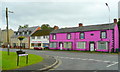
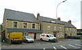
72 photos from this area
Area Information
Key information about the OX5 2AT including its size, population, and administrative classification.
- Area Type
- Postcode
- Area Size
- 2.0 hectares
- Population
- 1287
- Population Density
- 1255 people/km²
House Prices in OX5 2AT
43
Properties
£252,468
Average Sold Price
£61,000
Lowest Price
£443,000
Highest Price
Showing 43 properties
| Address | Type | Beds | Baths | Last Sale Price | Last Sale Date | |
|---|---|---|---|---|---|---|
| 23 Wise Avenue, Kidlington, OX5 2AT | Terraced | 4 | 1 | £443,000 | Oct 2024 | |
| 63 Wise Avenue, Kidlington, OX5 2AT | Terraced | 3 | 2 | £355,000 | Jun 2024 | |
| 59 Wise Avenue, Kidlington, OX5 2AT | house | 3 | - | £285,000 | Jun 2021 | |
| 27 Wise Avenue, Kidlington, OX5 2AT | Terraced | 2 | 1 | £265,000 | May 2019 | |
| 28 Wise Avenue, Kidlington, OX5 2AT | Terraced | 3 | 1 | £275,000 | Dec 2018 | |
| 51 Wise Avenue, Kidlington, OX5 2AT | Terraced | 3 | 1 | £325,000 | Nov 2017 | |
| 39 Wise Avenue, Kidlington, OX5 2AT | Terraced | 3 | 1 | £325,000 | Jul 2017 | |
| 33 Wise Avenue, Kidlington, OX5 2AT | Terraced | 3 | - | £278,000 | Mar 2017 | |
| 47 Wise Avenue, Kidlington, OX5 2AT | Terraced | 2 | - | £283,000 | Jul 2015 | |
| 65 Wise Avenue, Kidlington, OX5 2AT | Terraced | 3 | - | £218,500 | Nov 2012 |
Page 1 of 5
Energy Efficiency in OX5 2AT
Amenities
Schools
| Rank | School | Type | Entry gender | Ages |
|---|
Explore more schools in this area
Go to Schools tabDemographics
Household Size
Family (3-5 people)
most common
Accommodation Type
Houses
most common
Tenure
72
majority
Ethnic Group
White
most common
Religion
N/A
most common
Household Composition
N/A
most common
Age
47
median
Adults (30-64 years)
most common
Household Deprivation
N/A
with no deprivation
NS-SEC
34
in Lower managerial occupations
Explore more demographic insights in this area
Go to Demographics tabPlanning
Planning Constraints
- Flood RiskPremium
- Ramsar Wetland SitesPremium
- Area of Outstanding Natural BeautyPremium
- Protected Nature ReservePremium
- Protected WoodlandPremium