Area Overview for OX3 7AL
Photos of OX3 7AL
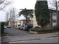


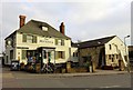


99 photos from this area
Area Information
Key information about the OX3 7AL including its size, population, and administrative classification.
- Area Type
- Postcode
- Area Size
- 6506 m²
- Population
- 1443
- Population Density
- 5189 people/km²
House Prices in OX3 7AL
29
Properties
£323,781
Average Sold Price
£80,000
Lowest Price
£490,000
Highest Price
Showing 29 properties
| Address | Type | Beds | Baths | Last Sale Price | Last Sale Date | |
|---|---|---|---|---|---|---|
| 63 New High Street, Oxford, OX3 7AL | Terraced | 2 | 1 | £408,000 | Jun 2025 | |
| 65 New High Street, Oxford, OX3 7AL | house | - | - | £420,000 | Mar 2025 | |
| 51 New High Street, Oxford, OX3 7AL | Terraced | 2 | 1 | £416,000 | May 2024 | |
| 45 New High Street, Oxford, OX3 7AL | Terraced | 3 | 1 | £485,000 | May 2023 | |
| 67B New High Street, Oxford, OX3 7AL | Flat | 2 | 1 | £310,000 | Feb 2019 | |
| 49 New High Street, Oxford, OX3 7AL | Terraced | 2 | 1 | £380,000 | Nov 2016 | |
| 59 New High Street, Oxford, OX3 7AL | Terraced | 3 | 1 | £490,000 | Nov 2016 | |
| 81 New High Street, Oxford, OX3 7AL | Semi-detached | 3 | 1 | £490,000 | May 2016 | |
| 61 New High Street, Oxford, OX3 7AL | Terraced | 2 | - | £360,000 | Oct 2014 | |
| 47 New High Street, Oxford, OX3 7AL | house | - | - | £280,000 | Dec 2011 |
Page 1 of 3
Energy Efficiency in OX3 7AL
Amenities
Schools
| Rank | School | Type | Entry gender | Ages |
|---|
Explore more schools in this area
Go to Schools tabDemographics
Household Size
One person
most common
Accommodation Type
Houses
most common
Tenure
51
majority
Ethnic Group
White
most common
Religion
N/A
most common
Household Composition
N/A
most common
Age
47
median
Adults (30-64 years)
most common
Household Deprivation
N/A
with no deprivation
NS-SEC
55
in Lower managerial occupations
Explore more demographic insights in this area
Go to Demographics tabPlanning
Planning Constraints
- Flood RiskPremium
- Ramsar Wetland SitesPremium
- Area of Outstanding Natural BeautyPremium
- Protected Nature ReservePremium
- Protected WoodlandPremium