Area Overview for OX3 7AD
Photos of OX3 7AD
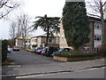


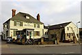


99 photos from this area
Area Information
Key information about the OX3 7AD including its size, population, and administrative classification.
- Area Type
- Postcode
- Area Size
- 1.1 hectares
- Population
- 1443
- Population Density
- 5189 people/km²
House Prices in OX3 7AD
35
Properties
£528,019
Average Sold Price
£177,000
Lowest Price
£1,050,000
Highest Price
Showing 35 properties
| Address | Type | Beds | Baths | Last Sale Price | Last Sale Date | |
|---|---|---|---|---|---|---|
| 101 Lime Walk, Oxford, OX3 7AD | Semi-detached | 3 | 1 | £505,000 | Sep 2025 | |
| 91 Lime Walk, Oxford, OX3 7AD | Flat | 1 | 1 | £376,000 | Feb 2025 | |
| Flat 3, 97 Lime Walk, Oxford, OX3 7AD | Flat | - | - | £477,000 | Feb 2025 | |
| 113 Lime Walk, Oxford, OX3 7AD | Detached | 3 | 1 | £657,000 | Feb 2025 | |
| 95 Lime Walk, Oxford, OX3 7AD | Flat | - | - | £376,000 | Dec 2024 | |
| 99 Lime Walk, Oxford, OX3 7AD | house | 2 | 1 | £910,000 | Feb 2024 | |
| 91 Lime Walk, Oxford, OX3 7AD | Detached | 2 | 2 | £1,050,000 | Nov 2022 | |
| 115 Lime Walk, Oxford, OX3 7AD | Retail | 4 | 2 | £865,000 | Jul 2022 | |
| 75 Lime Walk, Oxford, OX3 7AD | Flat | - | - | £301,500 | Sep 2021 | |
| 119 Lime Walk, Oxford, OX3 7AD | house | 4 | 2 | £810,000 | Jan 2021 |
Page 1 of 4
Energy Efficiency in OX3 7AD
Amenities
Schools
| Rank | School | Type | Entry gender | Ages |
|---|
Explore more schools in this area
Go to Schools tabDemographics
Household Size
One person
most common
Accommodation Type
Houses
most common
Tenure
51
majority
Ethnic Group
White
most common
Religion
N/A
most common
Household Composition
N/A
most common
Age
47
median
Adults (30-64 years)
most common
Household Deprivation
N/A
with no deprivation
NS-SEC
55
in Lower managerial occupations
Explore more demographic insights in this area
Go to Demographics tabPlanning
Planning Constraints
- Flood RiskPremium
- Ramsar Wetland SitesPremium
- Area of Outstanding Natural BeautyPremium
- Protected Nature ReservePremium
- Protected WoodlandPremium