Area Overview for OX29 9AN
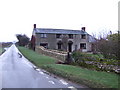
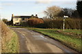
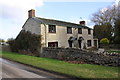
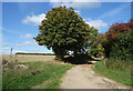
Photos of OX29 9AN

Area Information
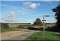
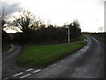
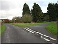
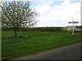
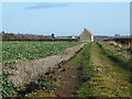
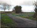
Living in OX29 9AN offers a quiet residential experience within a compact cluster covering 88.9 hectares. This small postcode area forms part of the wider Cotswold landscape in England, providing a setting where daily life moves at a considered pace. With a population of 1,131 residents, the neighbourhood maintains a tight-knit feel distinct from larger urban settlements. The low population density of 36 people per square kilometre ensures open spaces and a lack of congestion, making it an ideal choice for those seeking tranquility without complete isolation. You will find that the area balances rural charm with practical access to essential services found just beyond its immediate borders. The specific residential cluster nature of OX29 9AN means every street commands attention and residents often know their neighbours personally. This environment reflects a deliberate choice for a lifestyle grounded in stability and connection to the surrounding countryside. Buying a home here places you directly within a community defined by its modest yet deliberate scale, offering a genuine glimpse into traditional English suburban living.
- Area Type
- Postcode
- Area Size
- 88.9 hectares
- Population
- 1131
- Population Density
- 36 people/km²
Looking at the property market in OX29 9AN reveals a district firmly rooted in traditional homeownership rather than seasonal renting or investment deals. With 74% home ownership, the area functions primarily as a destination for individuals seeking to settle down permanently. This high percentage of owner-occupiers means that the local housing supply is largely comprised of established households rather than transient tenants. The accommodation type is exclusively houses, which aligns with the area’s status as a rural residential cluster. Buyers seeking flats or apartments will find none within this specific postcode, as the market is dedicated solely to detached, semi-detached, or terraced homes. This homogeneity creates a predictable market where property values reflect the desire for permanent residence rather than speculative trading. For those considering homes in OX29 9AN, the lack of private rental sector dominance suggests a stable investment environment. You are purchasing into a community where neighbours are likely to stay for decades, fostering a sense of continuity that rare in more volatile urban markets. The 88.9 hectares of land provide ample space for these houses to stand well apart, ensuring privacy and adherence to the quiet character of the locality.
House Prices in OX29 9AN
Showing 1 properties
| Address | Type | Beds | Baths | Last Sale Price | Last Sale Date | |
|---|---|---|---|---|---|---|
| Holywell Barn, Road From Worsham Turn To Asthall Leigh, Asthall Leigh, Witney, OX29 9AN | house | - | - | - | - |
Energy Efficiency in OX29 9AN
Your daily life in OX29 9AN centres on convenient access to essential amenities located within practical reach of the residential cluster. For groceries and general shopping, you have three named options to choose from. Co-op Burford and Co-op Centrum provide comprehensive retail services, while the nearby Spar offers quick top-up essentials. These retail outlets ensure you do not need to travel far for routine household requirements. Transport links are equally accessible, with several railway stations nearby that facilitate journeys across the region. Shipton Railway Station, Ascott, and Finstock Railway Station are all within easy reach, offering regular train services for commutes or leisure. For those requiring air travel, RAF Brize Norton airport is located closer than many city centres, providing a rare combination of rural living with proximate international connectivity. The presence of these five nearby retail stations and one major airport creates a lifestyle that balances provincial calm with national access. You can enjoy the comfort of living in a quiet neighbourhood while maintaining the ability to travel quickly to major hubs when needed. This mix of local shops and superior transport nodes defines the practical reality of living in this specific postcode area.
Amenities
Schools
| Rank | School | Type | Entry gender | Ages |
|---|
Explore more schools in this area
Go to Schools tabDemographics
The community in OX29 9AN is defined by a mature demographic profile and a strong preference for family homes. Residents in this area skew older than the national average, with a median age of 47 years. The most common age group comprises adults aged between 30 and 64 years, indicating a population that has likely stayed to raise families or retired within the locality. This age distribution suggests a stable community where children often grow up in the same streets they learned to live. Home ownership is the dominant housing tenure pattern, with 74% of residents owning their property outright or with a mortgage. This high rate of ownership reflects a long-term commitment to the neighbourhood rather than a transient rental market. The stock consists almost exclusively of houses, confirming the absence of high-rise apartments or urban flats typical of city centres. The predominant ethnic group is White, mirroring the broader demographic trends of the surrounding Cotswold region. These figures paint a clear picture of an established, owner-occupied community where long-term residency is the norm rather than the exception.
Household Size
Accommodation Type
Tenure
Ethnic Group
Religion
Household Composition
Age
Household Deprivation
NS-SEC
Explore more demographic insights in this area
Go to Demographics tabPlanning
Planning Constraints
- Flood RiskPremium
- Ramsar Wetland SitesPremium
- Area of Outstanding Natural BeautyPremium
- Protected Nature ReservePremium
- Protected WoodlandPremium