Area Overview for OX18 4ED
Photos of OX18 4ED
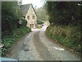
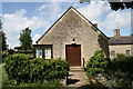
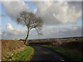
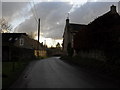
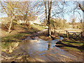
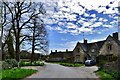
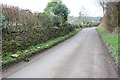
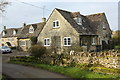
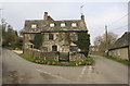
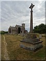
50 photos from this area
Area Information
Key information about the OX18 4ED including its size, population, and administrative classification.
- Area Type
- Postcode
- Area Size
- 19.1 hectares
- Population
- 1131
- Population Density
- 36 people/km²
House Prices in OX18 4ED
8
Properties
£1,110,787
Average Sold Price
£200,000
Lowest Price
£3,900,000
Highest Price
Showing 8 properties
| Address | Type | Beds | Baths | Last Sale Price | Last Sale Date | |
|---|---|---|---|---|---|---|
| Ilott Cottage, Street Through Swinbrook, Swinbrook, OX18 4ED | Detached | 3 | 1 | £628,007 | Jun 2024 | |
| Wychwood Lodge, Street Through Swinbrook, Swinbrook, OX18 4ED | house | - | - | £3,900,000 | Feb 2021 | |
| Keepers Lodge, Street Through Swinbrook, Swinbrook, OX18 4ED | house | - | - | £1,262,500 | Jun 2016 | |
| The Forge, Road From Beech Grove Fulbrook To Swinbrook, Swinbrook, OX18 4ED | Detached | - | - | £760,000 | Sep 2006 | |
| Yew Tree Cottage, Street Through Swinbrook, Swinbrook, OX18 4ED | Detached | - | - | £495,000 | Apr 2005 | |
| Stream Cottage, Street Through Swinbrook, Swinbrook, OX18 4ED | Detached | - | - | £530,000 | May 2004 | |
| Culvers Close, Street Through Swinbrook, Swinbrook, OX18 4ED | Detached | - | - | £200,000 | Mar 1997 | |
| Walnut Tree House, Road From Beech Grove Fulbrook To Swinbrook, Swinbrook, OX18 4ED | house | 4 | - | - | - |
Energy Efficiency in OX18 4ED
Amenities
Schools
| Rank | School | Type | Entry gender | Ages |
|---|
Explore more schools in this area
Go to Schools tabDemographics
Household Size
Two person
most common
Accommodation Type
Houses
most common
Tenure
74
majority
Ethnic Group
White
most common
Religion
N/A
most common
Household Composition
N/A
most common
Age
47
median
Adults (30-64 years)
most common
Household Deprivation
N/A
with no deprivation
NS-SEC
45
in Lower managerial occupations
Explore more demographic insights in this area
Go to Demographics tabPlanning
Planning Constraints
- Flood RiskPremium
- Ramsar Wetland SitesPremium
- Area of Outstanding Natural BeautyPremium
- Protected Nature ReservePremium
- Protected WoodlandPremium