Area Overview for OX29 8PE
Photos of OX29 8PE
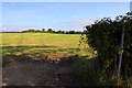
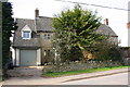
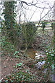
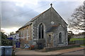
25 photos from this area
Area Information
Key information about the OX29 8PE including its size, population, and administrative classification.
- Area Type
- Postcode
- Area Size
- 9398 m²
- Population
- 1435
- Population Density
- 236 people/km²
House Prices in OX29 8PE
15
Properties
£496,000
Average Sold Price
£325,000
Lowest Price
£850,000
Highest Price
Showing 15 properties
| Address | Type | Beds | Baths | Last Sale Price | Last Sale Date | |
|---|---|---|---|---|---|---|
| Heronwood, 38 Stonesfield Road, Combe, OX29 8PE | Bungalow | 3 | 1 | £392,000 | Jun 2023 | |
| Langdales, 28 Stonesfield Road, Combe, OX29 8PE | Retail | 5 | - | £850,000 | Aug 2022 | |
| Allendale, 34 Stonesfield Road, Combe, OX29 8PE | Bungalow | 3 | 1 | £580,000 | Aug 2022 | |
| Lindrick, 22 Stonesfield Road, Combe, OX29 8PE | Chalet | 4 | - | £565,000 | Mar 2017 | |
| Long Ridge, 32 Stonesfield Road, Combe, OX29 8PE | Bungalow | 4 | - | £410,000 | Mar 2015 | |
| 16 Stonesfield Road, Combe, OX29 8PE | house | 3 | - | £325,000 | Aug 2011 | |
| 18 Stonesfield Road, Combe, OX29 8PE | house | 3 | - | £350,000 | Dec 2010 | |
| Annexe, 18 Stonesfield Road, Combe, OX29 8PE | Flat | - | - | - | - | |
| Mirwood, 24 Stonesfield Road, Combe, OX29 8PE | house | - | - | - | - | |
| Furzehill, 40 Stonesfield Road, Combe, OX29 8PE | Detached | - | - | - | - |
Page 1 of 2
Energy Efficiency in OX29 8PE
Amenities
Schools
| Rank | School | Type | Entry gender | Ages |
|---|
Explore more schools in this area
Go to Schools tabDemographics
Household Size
Two person
most common
Accommodation Type
Houses
most common
Tenure
77
majority
Ethnic Group
White
most common
Religion
N/A
most common
Household Composition
N/A
most common
Age
47
median
Adults (30-64 years)
most common
Household Deprivation
N/A
with no deprivation
NS-SEC
49
in Lower managerial occupations
Explore more demographic insights in this area
Go to Demographics tabPlanning
Planning Constraints
- Flood RiskPremium
- Ramsar Wetland SitesPremium
- Area of Outstanding Natural BeautyPremium
- Protected Nature ReservePremium
- Protected WoodlandPremium