Area Overview for OX29 7QX
Photos of OX29 7QX
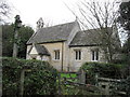
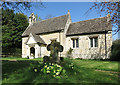
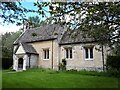
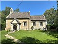
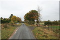
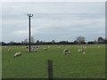
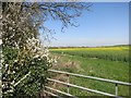
29 photos from this area
Area Information
Key information about the OX29 7QX including its size, population, and administrative classification.
- Area Type
- Postcode
- Area Size
- 2.1 km²
- Population
- 1497
- Population Density
- 61 people/km²
House Prices in OX29 7QX
8
Properties
£1,198,333
Average Sold Price
£965,000
Lowest Price
£1,650,000
Highest Price
Showing 8 properties
| Address | Type | Beds | Baths | Last Sale Price | Last Sale Date | |
|---|---|---|---|---|---|---|
| Linten Warren, Street Through Yelford, Yelford, Witney, OX29 7QX | house | - | - | £965,000 | Jun 2024 | |
| Milton House, Street Through Yelford, Yelford, Witney, OX29 7QX | Detached | 6 | - | £1,650,000 | Sep 2021 | |
| Rectory Cottage, Street Through Yelford, Yelford, Witney, OX29 7QX | Detached | 4 | - | £980,000 | Mar 2021 | |
| Yelford Manor, Street Through Yelford, Yelford, Witney, OX29 7QX | Cottage | 4 | - | - | - | |
| Broad Leas House, Street Through Yelford, Yelford, Witney, OX29 7QX | Detached | - | - | - | - | |
| Gylden Cottage, Street Through Yelford, Yelford, Witney, OX29 7QX | Semi-detached | - | - | - | - | |
| Coriander Cottage, Street Through Yelford, Yelford, Witney, OX29 7QX | Semi-detached | - | - | - | - | |
| College Farm, Street Through Yelford, Yelford, Witney, OX29 7QX | house | - | - | - | - |
Energy Efficiency in OX29 7QX
Amenities
Schools
| Rank | School | Type | Entry gender | Ages |
|---|
Explore more schools in this area
Go to Schools tabDemographics
Household Size
Two person
most common
Accommodation Type
Houses
most common
Tenure
79
majority
Ethnic Group
White
most common
Religion
N/A
most common
Household Composition
N/A
most common
Age
47
median
Adults (30-64 years)
most common
Household Deprivation
N/A
with no deprivation
NS-SEC
44
in Lower managerial occupations
Explore more demographic insights in this area
Go to Demographics tabPlanning
Planning Constraints
- Flood RiskPremium
- Ramsar Wetland SitesPremium
- Area of Outstanding Natural BeautyPremium
- Protected Nature ReservePremium
- Protected WoodlandPremium