Area Overview for OX29 4PN
Photos of OX29 4PN
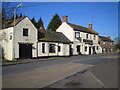

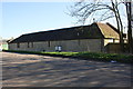

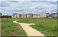
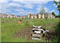
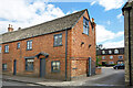
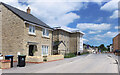
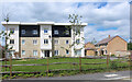
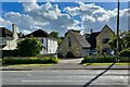
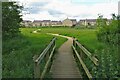

33 photos from this area
Area Information
Key information about the OX29 4PN including its size, population, and administrative classification.
- Area Type
- Postcode
- Area Size
- 1.1 hectares
- Population
- 1444
- Population Density
- 3977 people/km²
House Prices in OX29 4PN
13
Properties
£363,900
Average Sold Price
£157,000
Lowest Price
£570,000
Highest Price
Showing 13 properties
| Address | Type | Beds | Baths | Last Sale Price | Last Sale Date | |
|---|---|---|---|---|---|---|
| 63 Witney Road, Eynsham, OX29 4PN | house | - | - | £400,000 | Oct 2023 | |
| 55 Witney Road, Eynsham, OX29 4PN | house | - | - | £570,000 | Sep 2023 | |
| 71 Witney Road, Eynsham, OX29 4PN | house | - | - | £490,000 | Oct 2021 | |
| 57 Witney Road, Eynsham, OX29 4PN | Semi-detached | 3 | 1 | £330,000 | Aug 2019 | |
| 67 Witney Road, Eynsham, OX29 4PN | Semi-detached | 3 | 1 | £397,000 | Jul 2018 | |
| 59 Witney Road, Eynsham, OX29 4PN | house | - | - | £485,000 | Aug 2017 | |
| 65 Witney Road, Eynsham, OX29 4PN | Semi-detached | 3 | - | £325,000 | Mar 2014 | |
| 73 Witney Road, Eynsham, OX29 4PN | Detached | - | - | £290,000 | Jul 2006 | |
| 69 Witney Road, Eynsham, OX29 4PN | Semi-detached | - | - | £157,000 | Jul 2000 | |
| 77 Witney Road, Eynsham, OX29 4PN | Detached | 5 | 3 | £195,000 | Jul 1999 |
Page 1 of 2
Energy Efficiency in OX29 4PN
Amenities
Schools
| Rank | School | Type | Entry gender | Ages |
|---|
Explore more schools in this area
Go to Schools tabDemographics
Household Size
Two person
most common
Accommodation Type
Houses
most common
Tenure
81
majority
Ethnic Group
White
most common
Religion
N/A
most common
Household Composition
N/A
most common
Age
47
median
Adults (30-64 years)
most common
Household Deprivation
N/A
with no deprivation
NS-SEC
40
in Lower managerial occupations
Explore more demographic insights in this area
Go to Demographics tabPlanning
Planning Constraints
- Flood RiskPremium
- Ramsar Wetland SitesPremium
- Area of Outstanding Natural BeautyPremium
- Protected Nature ReservePremium
- Protected WoodlandPremium