Area Overview for OX29 4NP
Photos of OX29 4NP
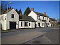

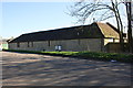

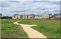
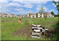
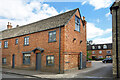
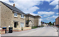
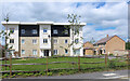
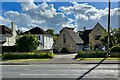
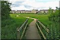
33 photos from this area
Area Information
Key information about the OX29 4NP including its size, population, and administrative classification.
- Area Type
- Postcode
- Area Size
- 2.6 hectares
- Population
- 1444
- Population Density
- 3977 people/km²
House Prices in OX29 4NP
60
Properties
£273,322
Average Sold Price
£59,500
Lowest Price
£434,000
Highest Price
Showing 60 properties
| Address | Type | Beds | Baths | Last Sale Price | Last Sale Date | |
|---|---|---|---|---|---|---|
| 74 Spareacre Lane, Eynsham, OX29 4NP | house | - | - | £410,000 | Jul 2025 | |
| 48 Spareacre Lane, Eynsham, OX29 4NP | house | - | - | £295,000 | May 2021 | |
| 104 Spareacre Lane, Eynsham, OX29 4NP | house | - | - | £415,000 | Jun 2020 | |
| 136 Spareacre Lane, Eynsham, OX29 4NP | Detached | 4 | 1 | £392,000 | Jun 2018 | |
| 78 Spareacre Lane, Eynsham, OX29 4NP | Semi-detached | 3 | 1 | £326,000 | Dec 2017 | |
| 112 Spareacre Lane, Eynsham, OX29 4NP | Detached | 4 | 1 | £315,000 | Nov 2017 | |
| 122 Spareacre Lane, Eynsham, OX29 4NP | Detached | 3 | 1 | £350,000 | Nov 2017 | |
| 128 Spareacre Lane, Eynsham, OX29 4NP | house | - | - | £434,000 | Apr 2017 | |
| 92 Spareacre Lane, Eynsham, OX29 4NP | Detached | 2 | 1 | £370,000 | Nov 2015 | |
| 54 Spareacre Lane, Eynsham, OX29 4NP | house | - | - | £280,000 | Oct 2015 |
Page 1 of 6
Energy Efficiency in OX29 4NP
Amenities
Schools
| Rank | School | Type | Entry gender | Ages |
|---|
Explore more schools in this area
Go to Schools tabDemographics
Household Size
Two person
most common
Accommodation Type
Houses
most common
Tenure
81
majority
Ethnic Group
White
most common
Religion
N/A
most common
Household Composition
N/A
most common
Age
47
median
Adults (30-64 years)
most common
Household Deprivation
N/A
with no deprivation
NS-SEC
40
in Lower managerial occupations
Explore more demographic insights in this area
Go to Demographics tabPlanning
Planning Constraints
- Flood RiskPremium
- Ramsar Wetland SitesPremium
- Area of Outstanding Natural BeautyPremium
- Protected Nature ReservePremium
- Protected WoodlandPremium