Area Overview for OX29 4PD
Photos of OX29 4PD
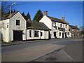

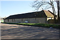

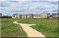
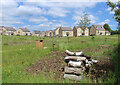
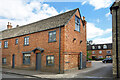
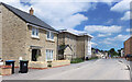
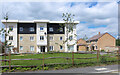
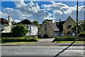
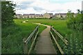
33 photos from this area
Area Information
Key information about the OX29 4PD including its size, population, and administrative classification.
- Area Type
- Postcode
- Area Size
- 1.1 hectares
- Population
- 1444
- Population Density
- 3977 people/km²
House Prices in OX29 4PD
23
Properties
£473,857
Average Sold Price
£215,000
Lowest Price
£970,000
Highest Price
Showing 23 properties
| Address | Type | Beds | Baths | Last Sale Price | Last Sale Date | |
|---|---|---|---|---|---|---|
| 88 Acre End Street, Eynsham, OX29 4PD | Semi-detached | 3 | 1 | £455,000 | Jun 2023 | |
| 52 Acre End Street, Eynsham, OX29 4PD | house | 2 | 1 | £330,000 | May 2022 | |
| 70 Acre End Street, Eynsham, OX29 4PD | Detached | - | - | £885,000 | Oct 2019 | |
| 82-84 Acre End Street, Eynsham, OX29 4PD | house | - | - | £407,000 | Oct 2019 | |
| 98 Acre End Street, Eynsham, OX29 4PD | house | - | - | £970,000 | Jun 2019 | |
| 72 Acre End Street, Eynsham, OX29 4PD | house | - | - | £525,000 | Nov 2015 | |
| 86 Acre End Street, Eynsham, OX29 4PD | house | - | - | £295,000 | Dec 2009 | |
| 58-60 Acre End Street, Eynsham, OX29 4PD | Terraced | - | - | £740,000 | Oct 2007 | |
| 78 Acre End Street, Eynsham, OX29 4PD | Terraced | - | - | £345,000 | Jul 2007 | |
| 100 Acre End Street, Eynsham, OX29 4PD | house | - | - | £385,000 | Mar 2006 |
Page 1 of 3
Energy Efficiency in OX29 4PD
Amenities
Schools
| Rank | School | Type | Entry gender | Ages |
|---|
Explore more schools in this area
Go to Schools tabDemographics
Household Size
Two person
most common
Accommodation Type
Houses
most common
Tenure
81
majority
Ethnic Group
White
most common
Religion
N/A
most common
Household Composition
N/A
most common
Age
47
median
Adults (30-64 years)
most common
Household Deprivation
N/A
with no deprivation
NS-SEC
40
in Lower managerial occupations
Explore more demographic insights in this area
Go to Demographics tabPlanning
Planning Constraints
- Flood RiskPremium
- Ramsar Wetland SitesPremium
- Area of Outstanding Natural BeautyPremium
- Protected Nature ReservePremium
- Protected WoodlandPremium