Area Overview for OX29 4DJ
Photos of OX29 4DJ
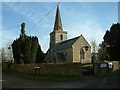
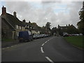
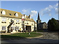
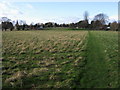
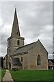
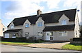
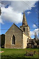
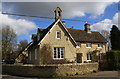
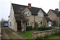
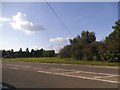
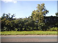
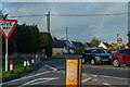
83 photos from this area
Area Information
Key information about the OX29 4DJ including its size, population, and administrative classification.
- Area Type
- Postcode
- Area Size
- 2.9 hectares
- Population
- 2007
- Population Density
- 170 people/km²
House Prices in OX29 4DJ
28
Properties
£281,875
Average Sold Price
£99,950
Lowest Price
£397,600
Highest Price
Showing 28 properties
| Address | Type | Beds | Baths | Last Sale Price | Last Sale Date | |
|---|---|---|---|---|---|---|
| 25 Eynsham Road, Cassington, OX29 4DJ | Semi-detached | 3 | 1 | £385,000 | Dec 2024 | |
| 47 Eynsham Road, Cassington, OX29 4DJ | Bungalow | - | - | £310,000 | May 2021 | |
| 53 Eynsham Road, Cassington, OX29 4DJ | Bungalow | - | - | £250,000 | Jan 2020 | |
| Old Orchard House, 39A Eynsham Road, Cassington, OX29 4DJ | Detached | 3 | 2 | £165,000 | Sep 2019 | |
| 27 Eynsham Road, Cassington, OX29 4DJ | house | - | - | £320,000 | Nov 2016 | |
| 69 Eynsham Road, Cassington, OX29 4DJ | Semi-detached | 3 | 1 | £369,950 | Sep 2015 | |
| 57 Eynsham Road, Cassington, OX29 4DJ | house | - | - | £345,000 | Apr 2011 | |
| 61 Eynsham Road, Cassington, OX29 4DJ | house | - | - | £397,600 | Jan 2011 | |
| 63 Eynsham Road, Cassington, OX29 4DJ | Semi-detached | 3 | - | £240,000 | Aug 2009 | |
| 45 Eynsham Road, Cassington, OX29 4DJ | Detached | - | - | £250,000 | Sep 2003 |
Page 1 of 3
Energy Efficiency in OX29 4DJ
Amenities
Schools
| Rank | School | Type | Entry gender | Ages |
|---|
Explore more schools in this area
Go to Schools tabDemographics
Household Size
Two person
most common
Accommodation Type
Houses
most common
Tenure
73
majority
Ethnic Group
White
most common
Religion
N/A
most common
Household Composition
N/A
most common
Age
47
median
Adults (30-64 years)
most common
Household Deprivation
N/A
with no deprivation
NS-SEC
49
in Lower managerial occupations
Explore more demographic insights in this area
Go to Demographics tabPlanning
Planning Constraints
- Flood RiskPremium
- Ramsar Wetland SitesPremium
- Area of Outstanding Natural BeautyPremium
- Protected Nature ReservePremium
- Protected WoodlandPremium