Area Overview for OX28 6LY
Photos of OX28 6LY
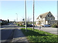
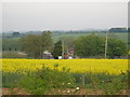
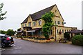
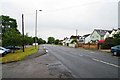
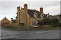

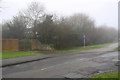
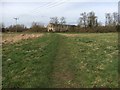
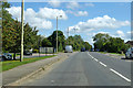
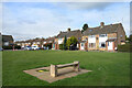
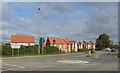
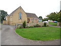
21 photos from this area
Area Information
Key information about the OX28 6LY including its size, population, and administrative classification.
- Area Type
- Postcode
- Area Size
- 6649 m²
- Population
- 2156
- Population Density
- 4749 people/km²
House Prices in OX28 6LY
14
Properties
£361,625
Average Sold Price
£210,000
Lowest Price
£950,000
Highest Price
Showing 14 properties
| Address | Type | Beds | Baths | Last Sale Price | Last Sale Date | |
|---|---|---|---|---|---|---|
| 3 Crundel Rise, Witney, OX28 6LY | Detached | 2 | 2 | £400,000 | Jan 2025 | |
| 5 Crundel Rise, Witney, OX28 6LY | house | - | - | £300,000 | Feb 2022 | |
| 7 Crundel Rise, Witney, OX28 6LY | Semi-detached | 2 | - | £285,000 | Jan 2022 | |
| 4A Crundel Rise, Witney, OX28 6LY | house | - | - | £420,000 | Sep 2021 | |
| 9 Crundel Rise, Witney, OX28 6LY | Semi-detached | 3 | - | £290,000 | Dec 2020 | |
| Crundel Cottage, Crundel Rise, Witney, OX28 6LY | Cottage | 3 | - | £375,000 | Jun 2014 | |
| 11 Crundel Rise, Witney, OX28 6LY | Detached | 3 | - | £315,000 | Apr 2014 | |
| 12 Crundel Rise, Witney, OX28 6LY | Detached | 3 | - | £325,000 | Aug 2013 | |
| 4 Crundel Rise, Witney, OX28 6LY | Detached | - | - | £232,000 | May 2009 | |
| 6 Crundel Rise, Witney, OX28 6LY | Terraced | 3 | 2 | £210,000 | Mar 2009 |
Page 1 of 2
Energy Efficiency in OX28 6LY
Amenities
Schools
| Rank | School | Type | Entry gender | Ages |
|---|
Explore more schools in this area
Go to Schools tabDemographics
Household Size
One person
most common
Accommodation Type
Houses
most common
Tenure
54
majority
Ethnic Group
White
most common
Religion
N/A
most common
Household Composition
N/A
most common
Age
47
median
Adults (30-64 years)
most common
Household Deprivation
N/A
with no deprivation
NS-SEC
38
in Lower managerial occupations
Explore more demographic insights in this area
Go to Demographics tabPlanning
Planning Constraints
- Flood RiskPremium
- Ramsar Wetland SitesPremium
- Area of Outstanding Natural BeautyPremium
- Protected Nature ReservePremium
- Protected WoodlandPremium