Area Overview for OX28 1HR
Photos of OX28 1HR
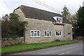
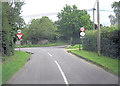
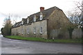
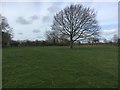
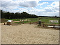
16 photos from this area
Area Information
Key information about the OX28 1HR including its size, population, and administrative classification.
- Area Type
- Postcode
- Area Size
- 9744 m²
- Population
- 1301
- Population Density
- 4990 people/km²
House Prices in OX28 1HR
23
Properties
£235,675
Average Sold Price
£119,500
Lowest Price
£300,000
Highest Price
Showing 23 properties
| Address | Type | Beds | Baths | Last Sale Price | Last Sale Date | |
|---|---|---|---|---|---|---|
| 49 Eastfield Road, Witney, OX28 1HR | house | - | - | £275,000 | Feb 2023 | |
| 91 Eastfield Road, Witney, OX28 1HR | Retail | 3 | 1 | £300,000 | Mar 2022 | |
| 75 Eastfield Road, Witney, OX28 1HR | house | - | - | £295,000 | Oct 2021 | |
| 69 Eastfield Road, Witney, OX28 1HR | house | - | - | £285,000 | Dec 2020 | |
| 83 Eastfield Road, Witney, OX28 1HR | Terraced | 3 | - | £245,000 | Mar 2019 | |
| 49A Eastfield Road, Witney, OX28 1HR | Detached | 3 | 2 | £290,000 | Feb 2016 | |
| 73 Eastfield Road, Witney, OX28 1HR | house | 3 | - | £188,000 | Mar 2012 | |
| 67 Eastfield Road, Witney, OX28 1HR | Semi-detached | - | - | £209,500 | Oct 2006 | |
| 79 Eastfield Road, Witney, OX28 1HR | house | - | - | £149,750 | Feb 2003 | |
| 59 Eastfield Road, Witney, OX28 1HR | house | - | - | £119,500 | Jan 2002 |
Page 1 of 3
Energy Efficiency in OX28 1HR
Amenities
Schools
| Rank | School | Type | Entry gender | Ages |
|---|
Explore more schools in this area
Go to Schools tabDemographics
Household Size
Family (3-5 people)
most common
Accommodation Type
Houses
most common
Tenure
56
majority
Ethnic Group
White
most common
Religion
N/A
most common
Household Composition
N/A
most common
Age
47
median
Adults (30-64 years)
most common
Household Deprivation
N/A
with no deprivation
NS-SEC
27
in Lower managerial occupations
Explore more demographic insights in this area
Go to Demographics tabPlanning
Planning Constraints
- Flood RiskPremium
- Ramsar Wetland SitesPremium
- Area of Outstanding Natural BeautyPremium
- Protected Nature ReservePremium
- Protected WoodlandPremium