Area Overview for OX28 1HL
Photos of OX28 1HL
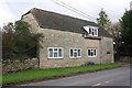
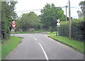
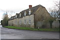
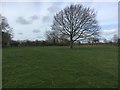
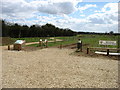
16 photos from this area
Area Information
Key information about the OX28 1HL including its size, population, and administrative classification.
- Area Type
- Postcode
- Area Size
- 4.9 hectares
- Population
- 1301
- Population Density
- 4990 people/km²
House Prices in OX28 1HL
24
Properties
£190,564
Average Sold Price
£89,950
Lowest Price
£412,500
Highest Price
Showing 24 properties
| Address | Type | Beds | Baths | Last Sale Price | Last Sale Date | |
|---|---|---|---|---|---|---|
| 129 Hailey Road, Witney, OX28 1HL | house | - | - | £412,500 | Apr 2019 | |
| 127 Hailey Road, Witney, OX28 1HL | Semi-detached | - | - | £235,000 | Jul 2006 | |
| 117 Hailey Road, Witney, OX28 1HL | Semi-detached | - | - | £175,000 | Mar 2006 | |
| 123 Hailey Road, Witney, OX28 1HL | Semi-detached | - | - | £169,500 | Jul 2001 | |
| 119 Hailey Road, Witney, OX28 1HL | Semi-detached | - | - | £128,000 | May 2000 | |
| 121 Hailey Road, Witney, OX28 1HL | Semi-detached | - | - | £89,950 | Jul 1999 | |
| 113 Hailey Road, Witney, OX28 1HL | Semi-detached | - | - | £124,000 | Apr 1999 | |
| 125 Hailey Road, Witney, OX28 1HL | Semi-detached | - | - | - | - | |
| 133 Hailey Road, Witney, OX28 1HL | Bungalow | - | - | - | - | |
| 155 Hailey Road, Witney, OX28 1HL | Bungalow | - | - | - | - |
Page 1 of 3
Energy Efficiency in OX28 1HL
Amenities
Schools
| Rank | School | Type | Entry gender | Ages |
|---|
Explore more schools in this area
Go to Schools tabDemographics
Household Size
Family (3-5 people)
most common
Accommodation Type
Houses
most common
Tenure
56
majority
Ethnic Group
White
most common
Religion
N/A
most common
Household Composition
N/A
most common
Age
47
median
Adults (30-64 years)
most common
Household Deprivation
N/A
with no deprivation
NS-SEC
27
in Lower managerial occupations
Explore more demographic insights in this area
Go to Demographics tabPlanning
Planning Constraints
- Flood RiskPremium
- Ramsar Wetland SitesPremium
- Area of Outstanding Natural BeautyPremium
- Protected Nature ReservePremium
- Protected WoodlandPremium