Area Overview for OX25 5PD
Photos of OX25 5PD
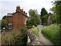
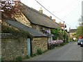
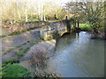
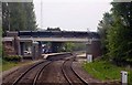

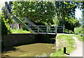
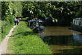
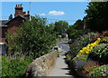
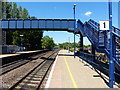
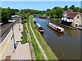
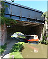
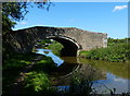
85 photos from this area
Area Information
Key information about the OX25 5PD including its size, population, and administrative classification.
- Area Type
- Postcode
- Area Size
- 23.3 hectares
- Population
- 1482
- Population Density
- 145 people/km²
House Prices in OX25 5PD
28
Properties
£533,739
Average Sold Price
£220,000
Lowest Price
£825,000
Highest Price
Showing 28 properties
| Address | Type | Beds | Baths | Last Sale Price | Last Sale Date | |
|---|---|---|---|---|---|---|
| Darville Cottage, Station Road, Lower Heyford, OX25 5PD | Cottage | 3 | 1 | £557,000 | Aug 2023 | |
| May House, Station Road, Lower Heyford, OX25 5PD | house | - | - | £450,000 | Jun 2021 | |
| Old Barn Cottage, Station Road, Lower Heyford, OX25 5PD | house | - | - | £425,000 | Mar 2021 | |
| Ham House, Station Road, Lower Heyford, OX25 5PD | Detached | 4 | - | £625,000 | Jul 2018 | |
| Garden House, Station Road, Lower Heyford, OX25 5PD | house | - | - | £770,000 | Mar 2015 | |
| The Beech House, Station Road, Lower Heyford, OX25 5PD | house | 5 | 3 | £825,000 | Mar 2011 | |
| Quiet Waters, Station Road, Lower Heyford, OX25 5PD | house | - | - | £500,000 | Nov 2009 | |
| Bridge House, Station Road, Lower Heyford, OX25 5PD | house | - | - | £730,000 | Jul 2007 | |
| Darville Lodge, Station Road, Lower Heyford, OX25 5PD | Terraced | - | - | £220,000 | Mar 2005 | |
| Darville House, Station Road, Lower Heyford, OX25 5PD | Semi-detached | 5 | 2 | £544,125 | Dec 2002 |
Page 1 of 3
Energy Efficiency in OX25 5PD
Amenities
Schools
| Rank | School | Type | Entry gender | Ages |
|---|
Explore more schools in this area
Go to Schools tabDemographics
Household Size
Two person
most common
Accommodation Type
Houses
most common
Tenure
73
majority
Ethnic Group
White
most common
Religion
N/A
most common
Household Composition
N/A
most common
Age
47
median
Adults (30-64 years)
most common
Household Deprivation
N/A
with no deprivation
NS-SEC
41
in Lower managerial occupations
Explore more demographic insights in this area
Go to Demographics tabPlanning
Planning Constraints
- Flood RiskPremium
- Ramsar Wetland SitesPremium
- Area of Outstanding Natural BeautyPremium
- Protected Nature ReservePremium
- Protected WoodlandPremium