Area Overview for OX2 9HB
Photos of OX2 9HB
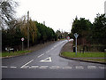
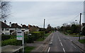
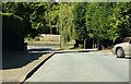
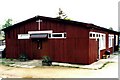
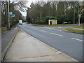
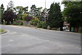
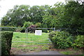
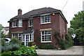
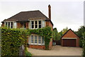
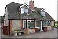
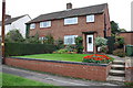
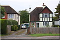
42 photos from this area
Area Information
Key information about the OX2 9HB including its size, population, and administrative classification.
- Area Type
- Postcode
- Area Size
- 2.8 hectares
- Population
- 1922
- Population Density
- 2429 people/km²
House Prices in OX2 9HB
31
Properties
£561,034
Average Sold Price
£215,000
Lowest Price
£1,020,000
Highest Price
Showing 31 properties
| Address | Type | Beds | Baths | Last Sale Price | Last Sale Date | |
|---|---|---|---|---|---|---|
| 54 Cumnor Hill, Oxford, OX2 9HB | Detached | 4 | 2 | £1,020,000 | Jan 2024 | |
| 48 Cumnor Hill, Oxford, OX2 9HB | Retail | 4 | 3 | £1,000,369 | Mar 2022 | |
| 50 Cumnor Hill, Oxford, OX2 9HB | house | - | - | £775,000 | Oct 2014 | |
| 42 Cumnor Hill, Oxford, OX2 9HB | Detached | 4 | - | £576,000 | Apr 2012 | |
| 44 Cumnor Hill, Oxford, OX2 9HB | house | 5 | - | £845,000 | Feb 2011 | |
| 62 Cumnor Hill, Oxford, OX2 9HB | Detached | 4 | 2 | £435,000 | Jul 2002 | |
| 54A Cumnor Hill, Oxford, OX2 9HB | Detached | 4 | 2 | £435,000 | Nov 2001 | |
| 34 Cumnor Hill, Oxford, OX2 9HB | Detached | - | - | £300,000 | Aug 1998 | |
| 56 Cumnor Hill, Oxford, OX2 9HB | Detached | 6 | 3 | £215,000 | Jan 1998 | |
| 40 Cumnor Hill, Oxford, OX2 9HB | Detached | 4 | 2 | £285,000 | Oct 1997 |
Page 1 of 4
Energy Efficiency in OX2 9HB
Amenities
Schools
| Rank | School | Type | Entry gender | Ages |
|---|
Explore more schools in this area
Go to Schools tabDemographics
Household Size
Two person
most common
Accommodation Type
Houses
most common
Tenure
81
majority
Ethnic Group
White
most common
Religion
N/A
most common
Household Composition
N/A
most common
Age
47
median
Adults (30-64 years)
most common
Household Deprivation
N/A
with no deprivation
NS-SEC
55
in Lower managerial occupations
Explore more demographic insights in this area
Go to Demographics tabPlanning
Planning Constraints
- Flood RiskPremium
- Ramsar Wetland SitesPremium
- Area of Outstanding Natural BeautyPremium
- Protected Nature ReservePremium
- Protected WoodlandPremium