Area Overview for OX2 9HU
Photos of OX2 9HU
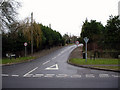
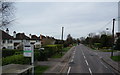
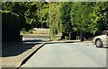
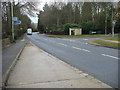
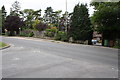
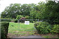
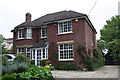
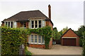
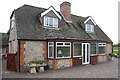
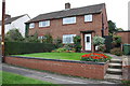
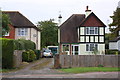
42 photos from this area
Area Information
Key information about the OX2 9HU including its size, population, and administrative classification.
- Area Type
- Postcode
- Area Size
- 3.4 hectares
- Population
- 1922
- Population Density
- 2429 people/km²
House Prices in OX2 9HU
24
Properties
£1,197,143
Average Sold Price
£600,000
Lowest Price
£1,970,000
Highest Price
Showing 24 properties
| Address | Type | Beds | Baths | Last Sale Price | Last Sale Date | |
|---|---|---|---|---|---|---|
| 80 Cumnor Hill, Oxford, OX2 9HU | Detached | 4 | 4 | £1,100,000 | Oct 2025 | |
| 70B Cumnor Hill, Oxford, OX2 9HU | house | - | - | £1,050,000 | Jun 2022 | |
| 72A Cumnor Hill, Oxford, OX2 9HU | Detached | 5 | 3 | £1,970,000 | May 2018 | |
| Idlewild, 72 Cumnor Hill, Oxford, OX2 9HU | Detached | 7 | 3 | £880,000 | Mar 2016 | |
| Badgers Brae, 84 Cumnor Hill, Oxford, OX2 9HU | house | 4 | 2 | £600,000 | Aug 2015 | |
| 90 Cumnor Hill, Oxford, OX2 9HU | house | - | - | £1,130,000 | Oct 2014 | |
| 74 Cumnor Hill, Oxford, OX2 9HU | house | - | - | £1,650,001 | Nov 2006 | |
| 78 Cumnor Hill, Oxford, OX2 9HU | Detached | 4 | 1 | - | - | |
| Apartment 3, 70 Cumnor Hill, Oxford, OX2 9HU | Flat | 2 | 2 | - | - | |
| 86 Cumnor Hill, Oxford, OX2 9HU | Detached | - | - | - | - |
Page 1 of 3
Energy Efficiency in OX2 9HU
Amenities
Schools
| Rank | School | Type | Entry gender | Ages |
|---|
Explore more schools in this area
Go to Schools tabDemographics
Household Size
Two person
most common
Accommodation Type
Houses
most common
Tenure
81
majority
Ethnic Group
White
most common
Religion
N/A
most common
Household Composition
N/A
most common
Age
47
median
Adults (30-64 years)
most common
Household Deprivation
N/A
with no deprivation
NS-SEC
55
in Lower managerial occupations
Explore more demographic insights in this area
Go to Demographics tabPlanning
Planning Constraints
- Flood RiskPremium
- Ramsar Wetland SitesPremium
- Area of Outstanding Natural BeautyPremium
- Protected Nature ReservePremium
- Protected WoodlandPremium