Area Overview for OX18 4PA
Photos of OX18 4PA
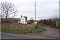
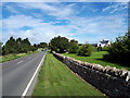
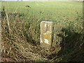
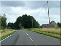
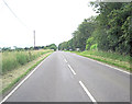
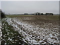
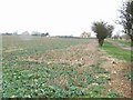
7 photos from this area
Area Information
Key information about the OX18 4PA including its size, population, and administrative classification.
- Area Type
- Postcode
- Area Size
- 29.9 hectares
- Population
- 1977
- Population Density
- 73 people/km²
House Prices in OX18 4PA
28
Properties
£879,643
Average Sold Price
£535,000
Lowest Price
£1,400,000
Highest Price
Showing 28 properties
| Address | Type | Beds | Baths | Last Sale Price | Last Sale Date | |
|---|---|---|---|---|---|---|
| 3 Shilton Road, Burford, OX18 4PA | Flat | 2 | 2 | £890,000 | Dec 2022 | |
| 5 Shilton Road, Burford, OX18 4PA | Flat | 2 | - | £800,000 | Aug 2021 | |
| Heathcote House, 4 Shilton Road, Burford, OX18 4PA | house | - | - | £932,500 | Jun 2018 | |
| 17 Shilton Road, Burford, OX18 4PA | Detached | 3 | 2 | £823,000 | Feb 2018 | |
| Tansley Farm House, Shilton Road, Burford, OX18 4PA | Detached | 4 | 2 | £1,395,000 | Jan 2018 | |
| The Chestnuts, 2 Shilton Road, Burford, OX18 4PA | Retail | 5 | 2 | £712,000 | Sep 2016 | |
| Cotswold, 6 Shilton Road, Burford, OX18 4PA | Detached | 2 | 2 | £1,125,000 | Mar 2016 | |
| 7 Shilton Road, Burford, OX18 4PA | Detached | 2 | - | £617,500 | Jan 2015 | |
| Westward Lodge, 21 Shilton Road, Burford, OX18 4PA | Detached | 5 | - | £1,400,000 | Aug 2014 | |
| Hillbrow, 1 Shilton Road, Burford, OX18 4PA | Detached | 5 | - | £535,000 | Apr 2014 |
Page 1 of 3
Energy Efficiency in OX18 4PA
Amenities
Schools
| Rank | School | Type | Entry gender | Ages |
|---|
Explore more schools in this area
Go to Schools tabDemographics
Household Size
Two person
most common
Accommodation Type
Houses
most common
Tenure
65
majority
Ethnic Group
White
most common
Religion
N/A
most common
Household Composition
N/A
most common
Age
47
median
Adults (30-64 years)
most common
Household Deprivation
N/A
with no deprivation
NS-SEC
41
in Lower managerial occupations
Explore more demographic insights in this area
Go to Demographics tabPlanning
Planning Constraints
- Flood RiskPremium
- Ramsar Wetland SitesPremium
- Area of Outstanding Natural BeautyPremium
- Protected Nature ReservePremium
- Protected WoodlandPremium