Area Overview for OX18 4FF
Photos of OX18 4FF
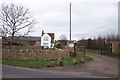
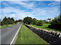
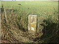
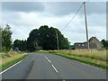
7 photos from this area
Area Information
Key information about the OX18 4FF including its size, population, and administrative classification.
- Area Type
- Postcode
- Area Size
- 6.3 hectares
- Population
- 1977
- Population Density
- 73 people/km²
House Prices in OX18 4FF
58
Properties
£516,233
Average Sold Price
£196,940
Lowest Price
£835,000
Highest Price
Showing 58 properties
| Address | Type | Beds | Baths | Last Sale Price | Last Sale Date | |
|---|---|---|---|---|---|---|
| 35 Forest Grove, Burford, OX18 4FF | Terraced | 2 | 2 | £542,500 | Oct 2025 | |
| 9 Forest Grove, Burford, OX18 4FF | Flat | - | - | £475,000 | Mar 2025 | |
| 23 Forest Grove, Burford, OX18 4FF | Flat | 2 | 2 | £405,000 | Feb 2025 | |
| 14 Forest Grove, Burford, OX18 4FF | house | 4 | 3 | £835,000 | Jan 2025 | |
| 39 Forest Grove, Burford, OX18 4FF | Flat | 2 | 2 | £399,950 | Apr 2024 | |
| 13 Forest Grove, Burford, OX18 4FF | Flat | 3 | 2 | £425,000 | Feb 2024 | |
| 25 Forest Grove, Burford, OX18 4FF | Flat | - | - | £375,000 | Sep 2023 | |
| 17 Forest Grove, Burford, OX18 4FF | Flat | - | - | £475,000 | May 2023 | |
| 15 Forest Grove, Burford, OX18 4FF | Flat | - | - | £550,000 | Apr 2023 | |
| 33 Forest Grove, Burford, OX18 4FF | house | - | - | £550,000 | Mar 2023 |
Page 1 of 6
Energy Efficiency in OX18 4FF
Amenities
Schools
| Rank | School | Type | Entry gender | Ages |
|---|
Explore more schools in this area
Go to Schools tabDemographics
Household Size
Two person
most common
Accommodation Type
Houses
most common
Tenure
65
majority
Ethnic Group
White
most common
Religion
N/A
most common
Household Composition
N/A
most common
Age
47
median
Adults (30-64 years)
most common
Household Deprivation
N/A
with no deprivation
NS-SEC
41
in Lower managerial occupations
Explore more demographic insights in this area
Go to Demographics tabPlanning
Planning Constraints
- Flood RiskPremium
- Ramsar Wetland SitesPremium
- Area of Outstanding Natural BeautyPremium
- Protected Nature ReservePremium
- Protected WoodlandPremium