Area Overview for OX18 4NB
Photos of OX18 4NB

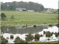
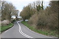
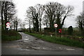

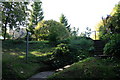


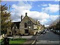
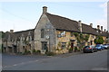
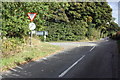
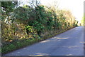
45 photos from this area
Area Information
Key information about the OX18 4NB including its size, population, and administrative classification.
- Area Type
- Postcode
- Area Size
- 2.8 hectares
- Population
- 1977
- Population Density
- 73 people/km²
House Prices in OX18 4NB
13
Properties
£954,864
Average Sold Price
£310,000
Lowest Price
£2,300,000
Highest Price
Showing 13 properties
| Address | Type | Beds | Baths | Last Sale Price | Last Sale Date | |
|---|---|---|---|---|---|---|
| Southwolds, 22 Tanners Lane, Burford, OX18 4NB | Detached | 3 | 2 | £830,000 | May 2025 | |
| May Cottage, 38 Tanners Lane, Burford, OX18 4NB | house | 3 | 1 | £912,500 | Aug 2022 | |
| The Beeches, 10 Tanners Lane, Burford, OX18 4NB | Detached | 6 | 4 | £2,300,000 | May 2022 | |
| Barnstone Cottage, 24 Tanners Lane, Burford, OX18 4NB | Retail | 4 | 4 | £1,281,000 | Apr 2022 | |
| Greenfields, 36 Tanners Lane, Burford, OX18 4NB | house | - | - | £840,000 | Apr 2022 | |
| Tanfield, 16 Tanners Lane, Burford, OX18 4NB | Detached | 4 | 2 | £995,000 | May 2014 | |
| Ambledown, 8 Tanners Lane, Burford, OX18 4NB | house | 3 | - | £675,000 | Aug 2011 | |
| Rowans, 6 Tanners Lane, Burford, OX18 4NB | house | 3 | - | £730,000 | Jan 2011 | |
| Muffety Cottage, 34 Tanners Lane, Burford, OX18 4NB | Detached | 2 | 1 | £1,300,000 | Dec 2003 | |
| North View, 20 Tanners Lane, Burford, OX18 4NB | Detached | - | - | £310,000 | Oct 2002 |
Page 1 of 2
Energy Efficiency in OX18 4NB
Amenities
Schools
| Rank | School | Type | Entry gender | Ages |
|---|
Explore more schools in this area
Go to Schools tabDemographics
Household Size
Two person
most common
Accommodation Type
Houses
most common
Tenure
65
majority
Ethnic Group
White
most common
Religion
N/A
most common
Household Composition
N/A
most common
Age
47
median
Adults (30-64 years)
most common
Household Deprivation
N/A
with no deprivation
NS-SEC
41
in Lower managerial occupations
Explore more demographic insights in this area
Go to Demographics tabPlanning
Planning Constraints
- Flood RiskPremium
- Ramsar Wetland SitesPremium
- Area of Outstanding Natural BeautyPremium
- Protected Nature ReservePremium
- Protected WoodlandPremium