Area Overview for OX18 4DE
Photos of OX18 4DE

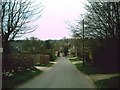
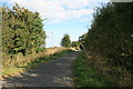
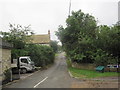
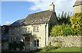
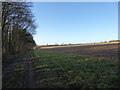
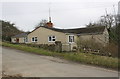
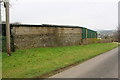
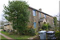
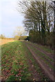
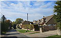
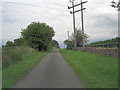
19 photos from this area
Area Information
Key information about the OX18 4DE including its size, population, and administrative classification.
- Area Type
- Postcode
- Area Size
- 75.5 hectares
- Population
- 1977
- Population Density
- 73 people/km²
House Prices in OX18 4DE
20
Properties
£524,000
Average Sold Price
£197,000
Lowest Price
£775,000
Highest Price
Showing 20 properties
| Address | Type | Beds | Baths | Last Sale Price | Last Sale Date | |
|---|---|---|---|---|---|---|
| Laburnum Cottage, Beech Grove, Fulbrook, Burford, OX18 4DE | house | - | - | £775,000 | Feb 2023 | |
| Ellen Cottage, Beech Grove, Fulbrook, Burford, OX18 4DE | Detached | 3 | 2 | £635,000 | Jun 2021 | |
| Wisteria Cottage, Beech Grove, Fulbrook, Burford, OX18 4DE | house | - | - | £485,000 | Aug 2018 | |
| Minstrel Cottage, Beech Grove, Fulbrook, Burford, OX18 4DE | house | - | - | £555,000 | Oct 2017 | |
| Enbre, Beech Grove, Fulbrook, Burford, OX18 4DE | Detached | 5 | 3 | £652,000 | Jan 2013 | |
| Staddle Stones, Beech Grove, Fulbrook, Burford, OX18 4DE | Detached | - | - | £316,000 | Oct 2012 | |
| Periton House, Beech Grove, Fulbrook, Burford, OX18 4DE | house | 4 | - | £560,000 | Jun 2012 | |
| Plum Tree House, Beech Grove, Fulbrook, Burford, OX18 4DE | house | 4 | - | £490,000 | Jul 2010 | |
| Duthies, Beech Grove, Fulbrook, Burford, OX18 4DE | house | - | - | £575,000 | Feb 2003 | |
| Springs, Beech Grove, Fulbrook, Burford, OX18 4DE | house | - | - | £197,000 | Apr 1997 |
Page 1 of 2
Energy Efficiency in OX18 4DE
Amenities
Schools
| Rank | School | Type | Entry gender | Ages |
|---|
Explore more schools in this area
Go to Schools tabDemographics
Household Size
Two person
most common
Accommodation Type
Houses
most common
Tenure
65
majority
Ethnic Group
White
most common
Religion
N/A
most common
Household Composition
N/A
most common
Age
47
median
Adults (30-64 years)
most common
Household Deprivation
N/A
with no deprivation
NS-SEC
41
in Lower managerial occupations
Explore more demographic insights in this area
Go to Demographics tabPlanning
Planning Constraints
- Flood RiskPremium
- Ramsar Wetland SitesPremium
- Area of Outstanding Natural BeautyPremium
- Protected Nature ReservePremium
- Protected WoodlandPremium