Area Overview for OX18 4BU
Photos of OX18 4BU


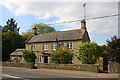
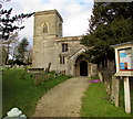


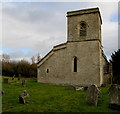
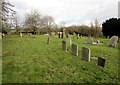
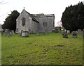
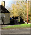

40 photos from this area
Area Information
Key information about the OX18 4BU including its size, population, and administrative classification.
- Area Type
- Postcode
- Area Size
- 3.4 hectares
- Population
- 1977
- Population Density
- 73 people/km²
House Prices in OX18 4BU
13
Properties
£334,667
Average Sold Price
£192,000
Lowest Price
£422,000
Highest Price
Showing 13 properties
| Address | Type | Beds | Baths | Last Sale Price | Last Sale Date | |
|---|---|---|---|---|---|---|
| Fox Tail Cottage, Shipton Road, Fulbrook, Burford, OX18 4BU | Detached | 3 | 3 | £422,000 | Sep 2018 | |
| Ladywell Cottage, Shipton Road, Fulbrook, Burford, OX18 4BU | Detached | - | - | £390,000 | Sep 2007 | |
| Whistler, Shipton Road, Fulbrook, Burford, OX18 4BU | Detached | 4 | 2 | £192,000 | Aug 2001 | |
| The House On The Hill, Shipton Road, Fulbrook, Burford, OX18 4BU | Detached | 4 | 2 | - | - | |
| Pudswell House, Shipton Road, Fulbrook, Burford, OX18 4BU | Detached | 4 | 2 | - | - | |
| Annexe, The House On The Hill, Shipton Road, Fulbrook, Burford, OX18 4BU | undefined | - | - | - | - | |
| Managers Accommodation, Masons Arms, Shipton Road, Fulbrook, Burford, OX18 4BU | Detached | - | - | - | - | |
| York Cottage, Shipton Road, Fulbrook, Burford, OX18 4BU | Detached | - | - | - | - | |
| Pen Cottage, Shipton Road, Fulbrook, Burford, OX18 4BU | Detached | - | - | - | - | |
| Old School, Shipton Road, Fulbrook, Burford, OX18 4BU | house | - | - | - | - |
Page 1 of 2
Energy Efficiency in OX18 4BU
Amenities
Schools
| Rank | School | Type | Entry gender | Ages |
|---|
Explore more schools in this area
Go to Schools tabDemographics
Household Size
Two person
most common
Accommodation Type
Houses
most common
Tenure
65
majority
Ethnic Group
White
most common
Religion
N/A
most common
Household Composition
N/A
most common
Age
47
median
Adults (30-64 years)
most common
Household Deprivation
N/A
with no deprivation
NS-SEC
41
in Lower managerial occupations
Explore more demographic insights in this area
Go to Demographics tabPlanning
Planning Constraints
- Flood RiskPremium
- Ramsar Wetland SitesPremium
- Area of Outstanding Natural BeautyPremium
- Protected Nature ReservePremium
- Protected WoodlandPremium