Area Overview for OX18 2QD
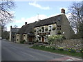
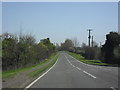
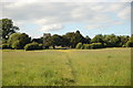
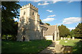
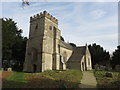
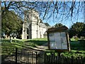
Photos of OX18 2QD


Area Information
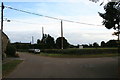
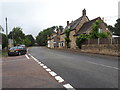
Living in OX18 2QD means settling into a very specific, low-density residential cluster covering just 1.8 hectares. This postcode holds 1,823 residents, creating a community spread far enough apart to feel spacious but close enough to form a genuine neighbourhood. The area is defined by its distinct size and quiet character rather than bustling city streets. You are looking at a place where every building counts and the population density is a mere 29 people per square kilometre. This low density shapes the daily rhythm of life here, offering a sense of openness often sought by those looking away from the pressure of major urban centres. The community identity sticks to these small limits, meaning local interactions can be more familiar than in sprawling suburbs. When you consider buying a home in OX18 2QD, you are entering a micro-commune with a clear, defined footprint. The small area size ensures that the local environment remains manageable and easy to navigate on foot or by bicycle. Residents here value the lack of congestion and the ability to maintain a private sphere while still engaging with the wider village network. This postcode represents a snapshot of rural-urban edge living where the physical constraints of the land define the community's boundaries.
- Area Type
- Postcode
- Area Size
- 1.8 hectares
- Population
- 1823
- Population Density
- 29 people/km²
The property market in OX18 2QD is characterised by a heavy emphasis on owner-occupation. With 67% of households in this postcode owning their homes, the market differs significantly from rent-heavy city centres. This statistic indicates that buyers are looking for a platform to settle permanently rather than a temporary base. The accommodation type data confirms that houses dominate the stock, meaning you will find traditional single-family dwellings alongside semi-detached properties. There are no flats or apartments in this specific 1.8-hectare cluster, which limits options for those seeking high-rise or multi-unit living. When you examine the available homes in OX18 2QD, you are looking at standard residential construction focused on privacy and garden space. The low population density of 29 people per square kilometre further reinforces the nature of the housing stock, as high-density blocks are neither feasible nor desirable here. Potential buyers should expect property prices to reflect the cost of land in such a small, exclusive area. The market operates on the principles of a buyer's footprint rather than a landlord's investment strategy. Because most residents are owner-occupiers, the turnover rate is naturally slower, offering stability for sellers but requiring patience from purchasers searching for the right match.
House Prices in OX18 2QD
No properties found in this postcode.
Energy Efficiency in OX18 2QD
A practical shopping nearby addresses the daily needs of residents without requiring long commutes. Within practical reach are five retail locations, including Morrisons Carterton, Aldi Carterton, and Asda Carterton. These major supermarkets provide a full range of groceries and household essentials. The presence of three large chain stores indicates robust access to affordable food and household goods. While the data highlights retail and transport nodes like RAF Brize Norton, the daily lifestyle focuses on these convenient shopping stops. You can manage your weekly shop and household inventory without venturing deep into unfamiliar territory. The proximity of these amenities means that errands become simple tasks rather than significant journeys. Local life revolves around these known outlets, which serve the immediate catchment area effectively. The 1.8-hectare cluster relies on these five nearby retail points for its commercial infrastructure. This setup ensures that essential services are within a short drive or walk, supporting an independent and convenient routine. Residents enjoy the freedom of choice between these familiar brands without the need for online ordering as a primary strategy.
Amenities
Schools
Families in OX18 2QD benefit from a cluster of educational facilities within easy reach. The nearest primary provision includes St Peter's Church of England Voluntary Aided Infants School in Alvescot and St Christopher's Church of England School. These institutions serve the foundational years for local children. For secondary education, the area is served by St Christopher's Church of England School, which operates as an academy and holds a good Ofsted rating. Similarly, St Peter's Church of England School in Alvescot also functions as an academy with a good Ofsted rating. This dual presence of well-rated academy schools provides strong options for older primary and secondary pupils. Special educational needs are supported nearby by the Sandwell Learning Centre, which also carries a good Ofsted rating. The mix of voluntary aided and academy structures offers different administrative approaches while maintaining high standards of education. You do not need to travel far to find reputable schooling, which is a significant advantage when balancing work and childcare. The proximity of these five named institutions creates a dedicated educational corridor for the residents of OX18 2QD and adjacent areas. Parents can rely on the Good ratings when evaluating the academic performance and trustworthiness of the local learning environment.
| Rank | School | Type | Entry gender | Ages |
|---|---|---|---|---|
| 1 | St Peter's Church of England Voluntary Aided Infants School, Alvescot | primary | N/A | N/A |
| 2 | St Christopher's Church of England School | primary | N/A | N/A |
| 3 | St Christopher's Church of England School | academy | N/A | N/A |
| 4 | St Peter's Church of England School, Alvescot | academy | N/A | N/A |
| 5 | Sandwell Learning Centre | special | N/A | N/A |
Explore more schools in this area
Go to Schools tabDemographics
The community profile of OX18 2QD reflects the needs of established families and professionals. The median age within the postcode area stands at 47 years, indicating a mature demographic. Adults aged between 30 and 64 years represent the most common age range, suggesting a stable population with financial independence. This age distribution typically correlates with higher rates of long-term residency and family stability. Home ownership is the dominant housing status, with 67% of residents owning their homes outright or with a mortgage. This high figure points to a neighbourhood where people have put down roots and intend to stay longer. The accommodation type is exclusively houses, which aligns perfectly with the demographic data showing a preference for detached or semi-detached living spaces over flats. The predominant ethnic group is White, mirroring the broader national trend for this specific region in England. You can expect a homogenous social fabric where community ties are often built over decades rather than years. This demographic structure means that funding for local services, particularly schools, is likely robust. The lack of rental pressure influences the social dynamic, creating an environment focused on stability rather than short-term leasing cycles.
Household Size
Accommodation Type
Tenure
Ethnic Group
Religion
Household Composition
Age
Household Deprivation
NS-SEC
Explore more demographic insights in this area
Go to Demographics tabPlanning
Planning Constraints
- Flood RiskPremium
- Ramsar Wetland SitesPremium
- Area of Outstanding Natural BeautyPremium
- Protected Nature ReservePremium
- Protected WoodlandPremium
- Crime RiskPremium