Area Overview for OX18 2PU
Photos of OX18 2PU
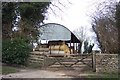


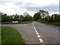
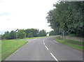

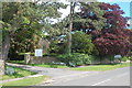
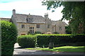
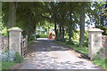


21 photos from this area
Area Information
Key information about the OX18 2PU including its size, population, and administrative classification.
- Area Type
- Postcode
- Area Size
- 1.0 km²
- Population
- 1823
- Population Density
- 29 people/km²
House Prices in OX18 2PU
45
Properties
£549,466
Average Sold Price
£249,950
Lowest Price
£1,950,000
Highest Price
Showing 45 properties
| Address | Type | Beds | Baths | Last Sale Price | Last Sale Date | |
|---|---|---|---|---|---|---|
| Drinkwaters Cottage, Main Road, Alvescot, OX18 2PU | house | 2 | 1 | £327,000 | Feb 2025 | |
| Jasmine Cottage, Main Road, Alvescot, OX18 2PU | Cottage | 3 | 2 | £435,000 | Jul 2024 | |
| Honeypot Cottage, Main Road, Alvescot, OX18 2PU | Detached | 2 | 1 | £370,000 | Jul 2023 | |
| Stoneycroft, Main Road, Alvescot, OX18 2PU | house | 2 | - | £1,950,000 | Jan 2023 | |
| Garden Cottage, Main Road, Alvescot, OX18 2PU | house | - | - | £815,000 | Jul 2022 | |
| Myrtle Cottage, Main Road, Alvescot, OX18 2PU | house | - | - | £275,000 | Aug 2019 | |
| Ivy Cottage, Station Road, Alvescot, OX18 2PU | Cottage | 2 | - | £250,000 | Jun 2019 | |
| Manor Cottage, Main Road, Alvescot, OX18 2PU | Detached | - | - | £630,000 | Aug 2018 | |
| Red Lion Cottage, Station Road, Alvescot, OX18 2PU | Terraced | 1 | 1 | £252,000 | Jun 2017 | |
| Shill Lodge, Main Road, Alvescot, OX18 2PU | Detached | 5 | - | £672,500 | Oct 2015 |
Page 1 of 5
Energy Efficiency in OX18 2PU
Amenities
Schools
| Rank | School | Type | Entry gender | Ages |
|---|
Explore more schools in this area
Go to Schools tabDemographics
Household Size
Two person
most common
Accommodation Type
Houses
most common
Tenure
67
majority
Ethnic Group
White
most common
Religion
N/A
most common
Household Composition
N/A
most common
Age
47
median
Adults (30-64 years)
most common
Household Deprivation
N/A
with no deprivation
NS-SEC
42
in Lower managerial occupations
Explore more demographic insights in this area
Go to Demographics tabPlanning
Planning Constraints
- Flood RiskPremium
- Ramsar Wetland SitesPremium
- Area of Outstanding Natural BeautyPremium
- Protected Nature ReservePremium
- Protected WoodlandPremium