Area Overview for OX18 2NE
Photos of OX18 2NE
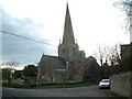
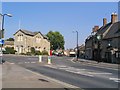
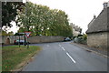
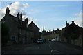
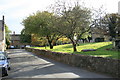
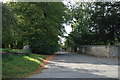
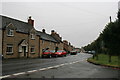
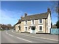
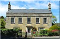
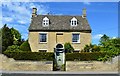
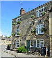
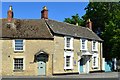
100 photos from this area
Area Information
Key information about the OX18 2NE including its size, population, and administrative classification.
- Area Type
- Postcode
- Area Size
- 1.1 hectares
- Population
- 1732
- Population Density
- 166 people/km²
House Prices in OX18 2NE
28
Properties
£300,291
Average Sold Price
£99,000
Lowest Price
£650,000
Highest Price
Showing 28 properties
| Address | Type | Beds | Baths | Last Sale Price | Last Sale Date | |
|---|---|---|---|---|---|---|
| Grafton Cottage, Church View, Bampton, OX18 2NE | Cottage | 2 | 1 | £310,000 | Oct 2024 | |
| Linden Cottage, Church View, Bampton, OX18 2NE | Semi-detached | 2 | 1 | £377,000 | Aug 2024 | |
| Vaizey Cottage, Church View, Bampton, OX18 2NE | Cottage | 2 | 1 | £355,000 | Jun 2021 | |
| Rose Cottage, Church View, Bampton, OX18 2NE | Cottage | 2 | 1 | £320,000 | Oct 2018 | |
| The Wychwoods, Church View, Bampton, OX18 2NE | Cottage | 3 | - | £360,000 | Jul 2018 | |
| 2 Church View, Bampton, OX18 2NE | Cottage | 3 | - | £335,000 | Mar 2016 | |
| Wisteria, Church View, Bampton, OX18 2NE | house | - | - | £200,000 | Aug 2012 | |
| The Croft House, Church View, Bampton, OX18 2NE | Detached | - | - | £650,000 | Aug 2012 | |
| 3 Church View, Bampton, OX18 2NE | Terraced | 4 | - | £500,000 | Jul 2012 | |
| 1 Church View, Bampton, OX18 2NE | house | 3 | - | £300,000 | Mar 2012 |
Page 1 of 3
Energy Efficiency in OX18 2NE
Amenities
Schools
| Rank | School | Type | Entry gender | Ages |
|---|
Explore more schools in this area
Go to Schools tabDemographics
Household Size
Two person
most common
Accommodation Type
Houses
most common
Tenure
80
majority
Ethnic Group
White
most common
Religion
N/A
most common
Household Composition
N/A
most common
Age
47
median
Adults (30-64 years)
most common
Household Deprivation
N/A
with no deprivation
NS-SEC
45
in Lower managerial occupations
Explore more demographic insights in this area
Go to Demographics tabPlanning
Planning Constraints
- Flood RiskPremium
- Ramsar Wetland SitesPremium
- Area of Outstanding Natural BeautyPremium
- Protected Nature ReservePremium
- Protected WoodlandPremium