Area Overview for OX18 2EN
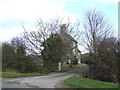
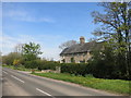
Photos of OX18 2EN

Area Information
OX18 2EN represents a small residential cluster covering 18.5 hectares with a population of 1,732 people. This compact postcode area sits within England's larger Oxfordshire framework, offering a tightly knit environment for those seeking a quieter settled life. The housing density reaches 166 people per square kilometre, creating a community that feels intimate yet possesses the infrastructure of a established neighbourhood. Residents here experience a distinct sense of locality rather than anonymous urban expansion. Daily life unfolds at a measured pace where neighbours often know one another. The area supports households within a specific geographic boundary, providing a clear definition for those searching for homes in this specific cluster. While the total population is modest, the concentration of residents ensures that essential services remain within practical reach. The character of living in OX18 2EN is defined by this blend of small-scale geography and established occupancy patterns. Potential buyers should view this postcode as a distinct micro-community rather than part of a larger, undefined sprawl. The physical boundaries contribute to a sense of place that differs significantly from more expansive suburban developments.
- Area Type
- Postcode
- Area Size
- 18.5 hectares
- Population
- 1732
- Population Density
- 166 people/km²
The property market in OX18 2EN reflects a classic owner-occupied framework with 80% of homes held by their residents. This statistic dictates the nature of the local housing stock, which consists almost entirely of houses. Potential buyers considering this area should expect a market driven by existing owners rather than landlords seeking tenancy returns. The accommodation type is uniformly residential houses, ruling out flats or purpose-built apartment blocks. This homogeneity suggests a community where property values are influenced by traditional house market dynamics rather than rental yield calculations. Buying a home in OX18 2EN means entering a territory where the majority of the population has achieved financial stability through ownership. The small scale of the cluster, covering just 18.5 hectares, further concentrates this housing stock. Transactions here likely involve freehold properties suited to families or individuals seeking a permanent base. The lack of rental properties indicates that this area is not conducive to buy-to-let investment strategies. Instead, it serves as a destination for those purchasing a primary residence. You will find a conventional brick-and-mortar housing market where ownership status is a central feature of daily life.
House Prices in OX18 2EN
Showing 2 properties
| Address | Type | Beds | Baths | Last Sale Price | Last Sale Date | |
|---|---|---|---|---|---|---|
| 3, Meadow Cottage, Buckland Road, Bampton, OX18 2EN | Semi-detached | 4 | 3 | £385,000 | Apr 2011 | |
| Meadow Cottage, Buckland Road, Bampton, OX18 2EN | Semi-detached | 4 | 3 | - | - |
Energy Efficiency in OX18 2EN
Residents of OX18 2EN enjoy access to five distinct retail venues within practical reach, ensuring everyday shopping needs are met without excessive travel. The Co-op Bampton, Lidl New, and Waitrose Little form the core of this retail network. These specific outlets provide a mix of general goods, budget groceries, and premium provisions. You will find a direct route to Waitrose, which often appeals to households preferring higher-end supermarket offerings. The presence of Lidl ensures access to affordable everyday items, balancing household budgeting requirements. Beyond retail, one airport facility, RAF Brize Norton, lies in the immediate vicinity. While primarily a military installation, its presence contributes to the regional infrastructure landscape. The lifestyle here is defined by proximity to these named amenities rather than on-site facilities. You do not need a vehicle to reach the main high street retailers under the names provided. The combination of these stores creates a functional shopping environment for the 1,732 residents. Daily errands remain manageable within the current amenity radius.
Amenities
Schools
Families living in OX18 2EN have access to the West Oxfordshire Pupil Referral Unit, which is the nearest educational institution listed for this location. This facility operates as an other-type school rather than a traditional primary, secondary, or special provision. There is no Ofsted rating data available for this specific entry in the provided information. There are no standard academic schools listed within the immediate vicinity of this postcode. The presence of a Pupil Referral Unit indicates an alternative education pathway exists for students who cannot attend mainstream schools. However, you will not find conventional state-funded primary or secondary schools directly associated with this specific housing cluster. Prospective parents must look beyond this immediate postcode boundary to find standard educational settings. The data does not include any academic institutions with teacher-led curricula for the main school age groups. This gap in local educational infrastructure means residents rely on transport to reach schools outside the OX18 2EN boundary. You should verify transport routes to external institutions before committing to a purchase here.
| Rank | School | Type | Entry gender | Ages |
|---|
Explore more schools in this area
Go to Schools tabDemographics
The community within OX18 2EN presents a distinctly mature profile with a median age of 47 years. Most residents currently fall within the adult age range of 30 to 64 years, indicating a neighbourhood dominated by working-age families and individuals approaching retirement. This demographic structure suggests a stable community where long-term settlement is common. Home ownership stands at 80%, reflecting a high level of tenure security among the population. Such a high percentage of owners typically correlates with lower tenant churn and a more invested community stance. The predominant ethnic group is White, which defines the current cultural makeup of this specific residential zone. Accommodation types are exclusively houses, meaning you will not find apartments or flats within this immediate postcode cluster. The absence of rental housing stock reinforces the owner-occupied nature of the area. These statistical realities create an environment where financial independence regarding housing is the norm. No alternative accommodation types exist in this specific 18.5-hectare footprint, ensuring a uniform living standard across the neighbourhood.
Household Size
Accommodation Type
Tenure
Ethnic Group
Religion
Household Composition
Age
Household Deprivation
NS-SEC
Explore more demographic insights in this area
Go to Demographics tabPlanning
Planning Constraints
- Flood RiskPremium
- Ramsar Wetland SitesPremium
- Area of Outstanding Natural BeautyPremium
- Protected Nature ReservePremium
- Protected WoodlandPremium