Area Overview for OX16 0DJ
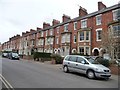
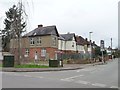
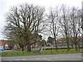
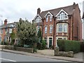
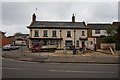
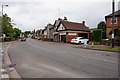
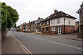
Photos of OX16 0DJ


Area Information
Living in OX16 0DJ offers a compact residential experience within a defined 1.3-hectare cluster in Oxfordshire. This specific postcode serves approximately 1,683 residents, creating a tight-knit environment where neighbours are naturally within close proximity. You will find this area distinct for its focus on housing rather than commercial space, aligning with the needs of those seeking a quiet domestic setting rather than a busy high street. The population density reaches 134,294 people per square kilometre, a figure that reflects the concentrated nature of this small residential zone compared to the wider Banbury region. Daily life here revolves around the immediate home environment, with residents relying heavily on nearby transport links and local services for their wider needs. The area functions as a pure sleeping quarter, providing a calm backdrop for families who value order and structure over urban sprawl. For prospective buyers, choosing OX16 0DJ means selecting a property in a space designed solely for living. You are not competing with busy retail zones or industrial parks for your quiet spaces; instead, the land designation ensures a consistent residential character. This focus on housing types simplifies the decision-making process, as you know exactly what surrounds your future garden or driveway. The compact size of the area means that wind can travel quickly across properties, but it also means that community events or local news reaches every house with remarkable speed. Living here requires an appreciation of small-scale planning, where every hectare counts towards the total population capacity.
- Area Type
- Postcode
- Area Size
- 1.3 hectares
- Population
- 1683
- Population Density
- 7236 people/km²
The property market in OX16 0DJ is characterised by a strong presence of houses, which form the overwhelming majority of the accommodation type in this postcode. With only 45% home ownership recorded among the 1,683 residents, the market presents a unique dynamic where buyers must compete with an existing cohort of renters. This lower ownership rate suggests that opportunities for new buyers may be frequent, as properties change hands at a pace determined by rental agreements rather than generational wealth transfer. If you are looking at homes in OX16 0DJ, you should expect to find a variety of tenure options alongside your standard brick-built houses. Because this is a small area of just 1.3 hectares, the selection of available properties will always be limited compared to larger towns. Yet, the predominance of houses means you will encounter traditional architecture suited to the Oxfordshire landscape. Home ownership levels at 45% are significantly lower than the national average, which can be an advantage for first-time buyers entering the market soon. You do not face the scarcity issues of an exclusively owner-occupied estate where sales are slow. Instead, the presence of many non-owner-occupiers creates a more fluid market for immediate completions. When assessing homes in this area, consider how the 45% ownership figure impacts the potential for price competition versus the availability of new stock.
House Prices in OX16 0DJ
Showing 48 properties
| Address | Type | Beds | Baths | Last Sale Price | Last Sale Date | |
|---|---|---|---|---|---|---|
| 54 Kings Road, Banbury, OX16 0DJ | Terraced | 1 | 1 | £190,000 | Oct 2025 | |
| 32 Kings Road, Banbury, OX16 0DJ | Semi-detached | 2 | 1 | £255,000 | Jun 2025 | |
| 58 Kings Road, Banbury, OX16 0DJ | Terraced | 2 | 1 | £235,000 | Sep 2024 | |
| 66 Kings Road, Banbury, OX16 0DJ | Terraced | 2 | 1 | £260,000 | Dec 2023 | |
| 18 Kings Road, Banbury, OX16 0DJ | house | - | - | £295,000 | Dec 2022 | |
| 72 Kings Road, Banbury, OX16 0DJ | Terraced | 2 | 1 | £195,968 | Aug 2021 | |
| 38 Kings Road, Banbury, OX16 0DJ | house | - | - | £162,000 | Mar 2021 | |
| 24 Kings Road, Banbury, OX16 0DJ | house | - | - | £210,000 | Jan 2019 | |
| 30 Kings Road, Banbury, OX16 0DJ | Semi-detached | 3 | - | £250,000 | Oct 2017 | |
| 92 Kings Road, Banbury, OX16 0DJ | Terraced | 3 | - | £240,000 | Dec 2016 |
Energy Efficiency in OX16 0DJ
Your daily itinerary in OX16 0DJ involves short trips to highly rated local amenities that serve the surrounding Banbury region. Within practical reach, you have access to three major supermarkets including Morrisons Daily Banbury, Iceland Banbury, and Tesco High. These food retailers provide everything from fresh produce to household necessities, ensuring you can stock your pantry without needing to travel far. For commuters, two railway stations offer convenient rail links to wider destinations: Banbury Railway Station and Kings Sutton Railway Station. You can use these hubs to access London and the rest of the UK network with minimal deviation from your postcode. This proximity to major retailers and transport hubs enhances the convenience of living in OX16 0DJ. You do not need to venture deep into the city for basic shopping, as the named venues are close enough for regular visits. The presence of Tesco High and Morrisons Daily indicates a well-supported local retail environment, even for a small residential area of 1,683 people. When planning your week, you can schedule errands at Iceland Banbury or bulk shop at the nearby Tesco High with confidence. These amenities are embedded in the fabric of daily life, reducing the time spent in traffic and increasing time at home.
Amenities
Schools
| Rank | School | Type | Entry gender | Ages |
|---|
Explore more schools in this area
Go to Schools tabDemographics
The community profile in OX16 0DJ reflects a settled population with a median age of 47 years. The most common age range consists of adults between 30 and 64 years, indicating that the area attracts working professionals and families who have established themselves in the region. Only 45% of households own their homes, a statistic that suggests a significant portion of the 1,683 residents reside in rental properties or shared ownership schemes. This mix means you will encounter a variety of living situations where neighbours may be long-term owners or tenants seeking stability in the same postcode. Houses form the predominant accommodation type in this cluster, meaning you will rarely see flats or purpose-built apartments. The physical structure of the homes likely dictates the layout of streets and gardens, creating a suburban feel rather than a dense urban one. While the predominant ethnic group is White, the age profile suggests a diverse mix of life stages within the same neighbourhood. The concentration of adults between 30 and 64 years often correlates with specific educational and employment needs as they move through the middle phase of their careers. You will find that the housing stock caters to these demographics, often featuring gardens and space sufficient for a growing family or retired couple. Living in OX16 0DJ means joining a demographic that values stability and established routines.
Household Size
Accommodation Type
Tenure
Ethnic Group
Religion
Household Composition
Age
Household Deprivation
NS-SEC
Explore more demographic insights in this area
Go to Demographics tabPlanning
Planning Constraints
- Flood RiskPremium
- Ramsar Wetland SitesPremium
- Area of Outstanding Natural BeautyPremium
- Protected Nature ReservePremium
- Protected WoodlandPremium