Area Overview for OX16 0BP
Photos of OX16 0BP
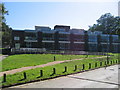
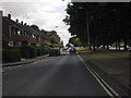
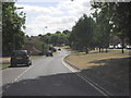
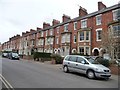
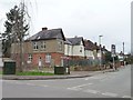
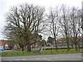
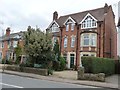
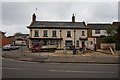
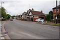
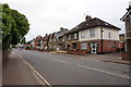
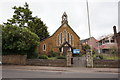
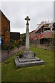
83 photos from this area
Area Information
Key information about the OX16 0BP including its size, population, and administrative classification.
- Area Type
- Postcode
- Area Size
- 8835 m²
- Population
- 1683
- Population Density
- 7236 people/km²
House Prices in OX16 0BP
19
Properties
£237,071
Average Sold Price
£55,000
Lowest Price
£450,000
Highest Price
Showing 19 properties
| Address | Type | Beds | Baths | Last Sale Price | Last Sale Date | |
|---|---|---|---|---|---|---|
| Bradgate Lodge, Boxhedge Road, Banbury, OX16 0BP | Bungalow | - | - | £450,000 | Dec 2022 | |
| Rena, Boxhedge Road, Banbury, OX16 0BP | Bungalow | 3 | 1 | £360,000 | Nov 2022 | |
| 18 Boxhedge Road, Banbury, OX16 0BP | Terraced | 4 | 1 | £285,000 | Jun 2021 | |
| Jesslyn, Boxhedge Road, Banbury, OX16 0BP | house | - | - | £212,500 | May 2021 | |
| Rose Cottage, 3 Boxhedge Road, Banbury, OX16 0BP | house | - | - | £327,500 | May 2017 | |
| Aubins, Boxhedge Road, Banbury, OX16 0BP | Semi-detached | 3 | - | £255,500 | May 2016 | |
| Radclive, 46 Boxhedge Road, Banbury, OX16 0BP | Detached | 3 | 1 | £219,500 | May 2015 | |
| Sunnyside, Boxhedge Road, Banbury, OX16 0BP | house | - | - | £195,000 | Jan 2014 | |
| New Farm House, Boxhedge Road, Banbury, OX16 0BP | house | 3 | - | £360,000 | Oct 2013 | |
| 4 Boxhedge Road, Banbury, OX16 0BP | Terraced | 4 | - | £305,000 | Oct 2003 |
Page 1 of 2
Energy Efficiency in OX16 0BP
Amenities
Schools
| Rank | School | Type | Entry gender | Ages |
|---|
Explore more schools in this area
Go to Schools tabDemographics
Household Size
Family (3-5 people)
most common
Accommodation Type
Houses
most common
Tenure
45
majority
Ethnic Group
White
most common
Religion
N/A
most common
Household Composition
N/A
most common
Age
47
median
Adults (30-64 years)
most common
Household Deprivation
N/A
with no deprivation
NS-SEC
24
in Lower managerial occupations
Explore more demographic insights in this area
Go to Demographics tabPlanning
Planning Constraints
- Flood RiskPremium
- Ramsar Wetland SitesPremium
- Area of Outstanding Natural BeautyPremium
- Protected Nature ReservePremium
- Protected WoodlandPremium