Area Overview for OX15 6LD
Photos of OX15 6LD


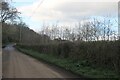
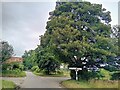
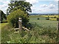
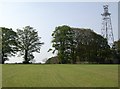
18 photos from this area
Area Information
Key information about the OX15 6LD including its size, population, and administrative classification.
- Area Type
- Postcode
- Area Size
- 39.1 hectares
- Population
- 1441
- Population Density
- 64 people/km²
House Prices in OX15 6LD
13
Properties
£520,714
Average Sold Price
£250,000
Lowest Price
£1,310,000
Highest Price
Showing 13 properties
| Address | Type | Beds | Baths | Last Sale Price | Last Sale Date | |
|---|---|---|---|---|---|---|
| Ambleside, Church Lane, Epwell, OX15 6LD | Detached | 5 | 4 | £1,310,000 | Dec 2024 | |
| Underlea House, Church Lane, Epwell, OX15 6LD | Cottage | 3 | 1 | £430,000 | Dec 2017 | |
| The Homestead, Church Lane, Epwell, OX15 6LD | Bungalow | - | - | £302,500 | May 2017 | |
| Tom Callows Cottage, Church Lane, Epwell, OX15 6LD | Cottage | 3 | 2 | £440,000 | Mar 2016 | |
| The Croft, Church Lane, Epwell, OX15 6LD | Detached | 4 | 3 | £642,500 | Dec 2014 | |
| Church View, Church Lane, Epwell, OX15 6LD | house | 3 | - | £270,000 | Jan 2012 | |
| Homestead Barn, Church Lane, Epwell, OX15 6LD | Detached | - | - | £250,000 | Nov 2007 | |
| Yarn Hill View, Church Lane, Epwell, OX15 6LD | house | - | - | - | - | |
| The Retreat, Church Farm, Church Lane, Epwell, OX15 6LD | house | - | - | - | - | |
| Sands Farm, Church Lane, Epwell, OX15 6LD | house | - | - | - | - |
Page 1 of 2
Energy Efficiency in OX15 6LD
Amenities
Schools
| Rank | School | Type | Entry gender | Ages |
|---|
Explore more schools in this area
Go to Schools tabDemographics
Household Size
Two person
most common
Accommodation Type
Houses
most common
Tenure
79
majority
Ethnic Group
White
most common
Religion
N/A
most common
Household Composition
N/A
most common
Age
47
median
Adults (30-64 years)
most common
Household Deprivation
N/A
with no deprivation
NS-SEC
44
in Lower managerial occupations
Explore more demographic insights in this area
Go to Demographics tabPlanning
Planning Constraints
- Flood RiskPremium
- Ramsar Wetland SitesPremium
- Area of Outstanding Natural BeautyPremium
- Protected Nature ReservePremium
- Protected WoodlandPremium