Area Overview for OX15 6LA
Photos of OX15 6LA
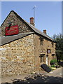
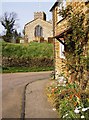
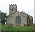
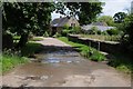
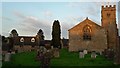
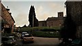
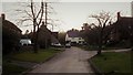
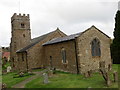
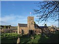
29 photos from this area
Area Information
Key information about the OX15 6LA including its size, population, and administrative classification.
- Area Type
- Postcode
- Area Size
- 4.2 hectares
- Population
- 1441
- Population Density
- 64 people/km²
House Prices in OX15 6LA
13
Properties
£395,125
Average Sold Price
£128,000
Lowest Price
£567,500
Highest Price
Showing 13 properties
| Address | Type | Beds | Baths | Last Sale Price | Last Sale Date | |
|---|---|---|---|---|---|---|
| Church House, The Square, Epwell, OX15 6LA | house | - | - | £390,000 | Mar 2016 | |
| The Elms, The Square, Epwell, OX15 6LA | Detached | - | - | £567,500 | Jul 2007 | |
| Highfield House, The Square, Epwell, OX15 6LA | Detached | - | - | £495,000 | Nov 2005 | |
| Bankside Cottage, The Square, Epwell, OX15 6LA | Detached | - | - | £128,000 | Dec 1995 | |
| Lyndver Barn, Manor Farm, The Square, Epwell, OX15 6LA | Detached | - | - | - | - | |
| Farm Buildings Part Of, Manor Farm, The Square, Epwell, OX15 6LA | Farm | - | - | - | - | |
| Brookfield View, The Square, Epwell, OX15 6LA | Detached | - | - | - | - | |
| The Corner House, The Square, Epwell, OX15 6LA | Semi-detached | - | - | - | - | |
| The Old Bakery, The Square, Epwell, OX15 6LA | house | - | - | - | - | |
| Trotters, The Square, Epwell, OX15 6LA | house | - | - | - | - |
Page 1 of 2
Energy Efficiency in OX15 6LA
Amenities
Schools
| Rank | School | Type | Entry gender | Ages |
|---|
Explore more schools in this area
Go to Schools tabDemographics
Household Size
Two person
most common
Accommodation Type
Houses
most common
Tenure
79
majority
Ethnic Group
White
most common
Religion
N/A
most common
Household Composition
N/A
most common
Age
47
median
Adults (30-64 years)
most common
Household Deprivation
N/A
with no deprivation
NS-SEC
44
in Lower managerial occupations
Explore more demographic insights in this area
Go to Demographics tabPlanning
Planning Constraints
- Flood RiskPremium
- Ramsar Wetland SitesPremium
- Area of Outstanding Natural BeautyPremium
- Protected Nature ReservePremium
- Protected WoodlandPremium