Area Overview for OX14 5HP
Photos of OX14 5HP
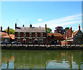
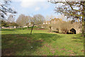


100 photos from this area
Area Information
Key information about the OX14 5HP including its size, population, and administrative classification.
- Area Type
- Postcode
- Area Size
- 8340 m²
- Population
- 1866
- Population Density
- 4876 people/km²
House Prices in OX14 5HP
19
Properties
£370,950
Average Sold Price
£240,000
Lowest Price
£650,000
Highest Price
Showing 19 properties
| Address | Type | Beds | Baths | Last Sale Price | Last Sale Date | |
|---|---|---|---|---|---|---|
| 2, Wharf Cottage, Wilsham Road, Abingdon, OX14 5HP | Semi-detached | 2 | 1 | £410,000 | Jun 2025 | |
| 1, Wharf Cottage, Wilsham Road, Abingdon, OX14 5HP | Semi-detached | 2 | 2 | £325,000 | Dec 2022 | |
| Andersey View, Wilsham Road, Abingdon, OX14 5HP | Bungalow | 2 | - | £650,000 | Jan 2021 | |
| Formerly The Isis, Wilsham Road, Abingdon, OX14 5HP | house | - | - | £375,000 | Sep 2018 | |
| Regatta House, Wilsham Road, Abingdon, OX14 5HP | house | - | - | £345,000 | Aug 2018 | |
| Pendower, Wilsham Road, Abingdon, OX14 5HP | Detached | 4 | - | £347,500 | Jan 2016 | |
| The Nook, Wilsham Road, Abingdon, OX14 5HP | Bungalow | 2 | 1 | £240,000 | Dec 2015 | |
| 19 Wilsham Road, Abingdon, OX14 5HP | Semi-detached | 4 | - | £350,000 | Jun 2014 | |
| Riverside, Wilsham Road, Abingdon, OX14 5HP | Semi-detached | - | - | £425,000 | Jul 2010 | |
| 20 Wilsham Road, Abingdon, OX14 5HP | Semi-detached | - | - | £242,000 | Aug 2006 |
Page 1 of 2
Energy Efficiency in OX14 5HP
Amenities
Schools
| Rank | School | Type | Entry gender | Ages |
|---|
Explore more schools in this area
Go to Schools tabDemographics
Household Size
One person
most common
Accommodation Type
Houses
most common
Tenure
63
majority
Ethnic Group
White
most common
Religion
N/A
most common
Household Composition
N/A
most common
Age
47
median
Adults (30-64 years)
most common
Household Deprivation
N/A
with no deprivation
NS-SEC
41
in Lower managerial occupations
Explore more demographic insights in this area
Go to Demographics tabPlanning
Planning Constraints
- Flood RiskPremium
- Ramsar Wetland SitesPremium
- Area of Outstanding Natural BeautyPremium
- Protected Nature ReservePremium
- Protected WoodlandPremium