Area Overview for OX14 5EB
Photos of OX14 5EB
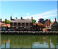
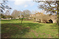
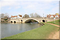
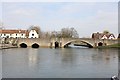
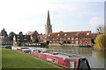
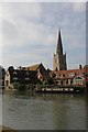
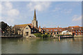
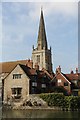
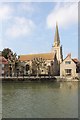
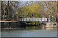
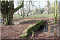
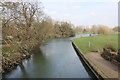
100 photos from this area
Area Information
Key information about the OX14 5EB including its size, population, and administrative classification.
- Area Type
- Postcode
- Area Size
- 1.4 hectares
- Population
- 1843
- Population Density
- 5443 people/km²
House Prices in OX14 5EB
17
Properties
£462,429
Average Sold Price
£138,000
Lowest Price
£1,075,000
Highest Price
Showing 17 properties
| Address | Type | Beds | Baths | Last Sale Price | Last Sale Date | |
|---|---|---|---|---|---|---|
| 40 East St Helen Street, Abingdon, OX14 5EB | house | - | - | £550,000 | Mar 2022 | |
| 48 East St Helen Street, Abingdon, OX14 5EB | Terraced | 3 | - | £344,000 | Dec 2013 | |
| Riverside House, 38 East St Helen Street, Abingdon, OX14 5EB | Detached | 5 | 4 | £1,075,000 | Jun 2013 | |
| 56 East St Helen Street, Abingdon, OX14 5EB | house | - | - | £345,000 | Mar 2009 | |
| 42 East St Helen Street, Abingdon, OX14 5EB | house | - | - | £138,000 | Jan 2009 | |
| 46 East St Helen Street, Abingdon, OX14 5EB | Semi-detached | 6 | 3 | £500,000 | Jul 2002 | |
| 52 East St Helen Street, Abingdon, OX14 5EB | Terraced | - | - | £285,000 | Nov 1999 | |
| 34 East St Helen Street, Abingdon, OX14 5EB | Terraced | 5 | 4 | - | - | |
| The Flat, 28 East St Helen Street, Abingdon, OX14 5EB | undefined | - | - | - | - | |
| 24 East St Helen Street, Abingdon, OX14 5EB | Terraced | - | - | - | - |
Page 1 of 2
Energy Efficiency in OX14 5EB
Amenities
Schools
| Rank | School | Type | Entry gender | Ages |
|---|
Explore more schools in this area
Go to Schools tabDemographics
Household Size
One person
most common
Accommodation Type
Flats
most common
Tenure
45
majority
Ethnic Group
White
most common
Religion
N/A
most common
Household Composition
N/A
most common
Age
47
median
Adults (30-64 years)
most common
Household Deprivation
N/A
with no deprivation
NS-SEC
49
in Lower managerial occupations
Explore more demographic insights in this area
Go to Demographics tabPlanning
Planning Constraints
- Flood RiskPremium
- Ramsar Wetland SitesPremium
- Area of Outstanding Natural BeautyPremium
- Protected Nature ReservePremium
- Protected WoodlandPremium