Area Overview for OX14 3NG
Photos of OX14 3NG
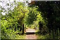
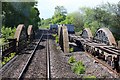
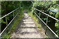
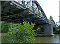
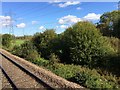
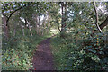
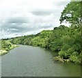
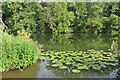
32 photos from this area
Area Information
Key information about the OX14 3NG including its size, population, and administrative classification.
- Area Type
- Postcode
- Area Size
- 1.1 km²
- Population
- 1279
- Population Density
- 155 people/km²
House Prices in OX14 3NG
9
Properties
£687,500
Average Sold Price
£125,000
Lowest Price
£1,250,000
Highest Price
Showing 9 properties
| Address | Type | Beds | Baths | Last Sale Price | Last Sale Date | |
|---|---|---|---|---|---|---|
| Conchiglia, Thrupp Lane, Radley, Abingdon, OX14 3NG | Detached | 5 | 5 | £1,250,000 | Feb 2023 | |
| Rettford, Thrupp Lane, Radley, Abingdon, OX14 3NG | Detached | - | - | £125,000 | Nov 1996 | |
| Sandles, Thrupp Lane, Radley, Abingdon, OX14 3NG | undefined | - | - | - | - | |
| 5, Home Farm Barns, Thrupp Lane, Radley, Abingdon, OX14 3NG | Office | - | - | - | - | |
| Caravan, Tuckwells Gravel Pit, Road Running Through Lower Radley, Lower Radley, Abingdon, OX14 3NG | Mobile Home | - | - | - | - | |
| Annexe At, Conchiglia, Thrupp Lane, Radley, Abingdon, OX14 3NG | Flat | - | - | - | - | |
| Gooseacre Farm, Thrupp Lane, Radley, Abingdon, OX14 3NG | Semi-detached | - | - | - | - | |
| 3, Home Farm Barns, Thrupp Lane, Radley, Abingdon, OX14 3NG | Office | - | - | - | - | |
| Gooseacre Farm Cottage, Thrupp Lane, Radley, Abingdon, OX14 3NG | Cottage | 2 | 1 | - | - |
Energy Efficiency in OX14 3NG
Amenities
Schools
| Rank | School | Type | Entry gender | Ages |
|---|
Explore more schools in this area
Go to Schools tabDemographics
Household Size
Two person
most common
Accommodation Type
Houses
most common
Tenure
82
majority
Ethnic Group
White
most common
Religion
N/A
most common
Household Composition
N/A
most common
Age
47
median
Adults (30-64 years)
most common
Household Deprivation
N/A
with no deprivation
NS-SEC
47
in Lower managerial occupations
Explore more demographic insights in this area
Go to Demographics tabPlanning
Planning Constraints
- Flood RiskPremium
- Ramsar Wetland SitesPremium
- Area of Outstanding Natural BeautyPremium
- Protected Nature ReservePremium
- Protected WoodlandPremium