Area Overview for OX14 3BL
Photos of OX14 3BL
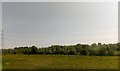
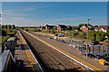
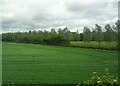
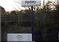
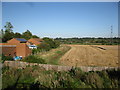
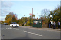
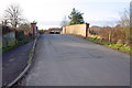
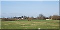
24 photos from this area
Area Information
Key information about the OX14 3BL including its size, population, and administrative classification.
- Area Type
- Postcode
- Area Size
- 8.6 hectares
- Population
- 1279
- Population Density
- 155 people/km²
House Prices in OX14 3BL
15
Properties
£509,550
Average Sold Price
£280,000
Lowest Price
£800,000
Highest Price
Showing 15 properties
| Address | Type | Beds | Baths | Last Sale Price | Last Sale Date | |
|---|---|---|---|---|---|---|
| 2 Gooseacre, Radley, Abingdon, OX14 3BL | Detached | 5 | 3 | £800,000 | Nov 2022 | |
| Conifers, Gooseacre, Radley, Abingdon, OX14 3BL | Detached | 4 | 2 | £655,000 | Aug 2019 | |
| 10 Gooseacre, Radley, Abingdon, OX14 3BL | Detached | 4 | 2 | £538,000 | Aug 2019 | |
| 4 Gooseacre, Radley, Abingdon, OX14 3BL | Detached | 4 | 2 | £510,000 | Oct 2018 | |
| 5 Gooseacre, Radley, Abingdon, OX14 3BL | Detached | 4 | 1 | £517,500 | Jul 2018 | |
| 7 Gooseacre, Radley, Abingdon, OX14 3BL | Detached | 4 | 2 | £525,000 | Oct 2016 | |
| Hidcote, Gooseacre, Radley, Abingdon, OX14 3BL | Detached | 4 | - | £440,000 | Jul 2011 | |
| 12 Gooseacre, Radley, Abingdon, OX14 3BL | house | - | - | £400,000 | Apr 2007 | |
| Ashbrook, Gooseacre, Radley, Abingdon, OX14 3BL | Detached | - | - | £430,000 | Feb 2006 | |
| 1 Gooseacre, Radley, Abingdon, OX14 3BL | Detached | - | - | £280,000 | Nov 2001 |
Page 1 of 2
Energy Efficiency in OX14 3BL
Amenities
Schools
| Rank | School | Type | Entry gender | Ages |
|---|
Explore more schools in this area
Go to Schools tabDemographics
Household Size
Two person
most common
Accommodation Type
Houses
most common
Tenure
82
majority
Ethnic Group
White
most common
Religion
N/A
most common
Household Composition
N/A
most common
Age
47
median
Adults (30-64 years)
most common
Household Deprivation
N/A
with no deprivation
NS-SEC
47
in Lower managerial occupations
Explore more demographic insights in this area
Go to Demographics tabPlanning
Planning Constraints
- Flood RiskPremium
- Ramsar Wetland SitesPremium
- Area of Outstanding Natural BeautyPremium
- Protected Nature ReservePremium
- Protected WoodlandPremium