Area Overview for OX14 1YW
Photos of OX14 1YW
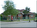
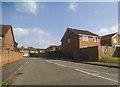


23 photos from this area
Area Information
Key information about the OX14 1YW including its size, population, and administrative classification.
- Area Type
- Postcode
- Area Size
- 1.6 hectares
- Population
- 1411
- Population Density
- 5788 people/km²
House Prices in OX14 1YW
37
Properties
£280,648
Average Sold Price
£87,000
Lowest Price
£542,500
Highest Price
Showing 37 properties
| Address | Type | Beds | Baths | Last Sale Price | Last Sale Date | |
|---|---|---|---|---|---|---|
| 42 Foster Road, Abingdon, OX14 1YW | Detached | 4 | 1 | £515,000 | May 2025 | |
| 71 Foster Road, Abingdon, OX14 1YW | Detached | 4 | 2 | £505,000 | Dec 2023 | |
| 61 Foster Road, Abingdon, OX14 1YW | Detached | 4 | 1 | £542,500 | Nov 2023 | |
| 59 Foster Road, Abingdon, OX14 1YW | Detached | 4 | 2 | £415,000 | Nov 2020 | |
| 44 Foster Road, Abingdon, OX14 1YW | Detached | 4 | 2 | £440,000 | Sep 2016 | |
| 66 Foster Road, Abingdon, OX14 1YW | Detached | 3 | - | £318,000 | Feb 2014 | |
| 69 Foster Road, Abingdon, OX14 1YW | Detached | 4 | - | £358,000 | Oct 2012 | |
| 38 Foster Road, Abingdon, OX14 1YW | house | - | - | £314,000 | Oct 2011 | |
| 47 Foster Road, Abingdon, OX14 1YW | Detached | 4 | 3 | £322,500 | Aug 2010 | |
| 39 Foster Road, Abingdon, OX14 1YW | house | 4 | - | £268,000 | Mar 2010 |
Page 1 of 4
Energy Efficiency in OX14 1YW
Amenities
Schools
| Rank | School | Type | Entry gender | Ages |
|---|
Explore more schools in this area
Go to Schools tabDemographics
Household Size
Two person
most common
Accommodation Type
Houses
most common
Tenure
72
majority
Ethnic Group
White
most common
Religion
N/A
most common
Household Composition
N/A
most common
Age
47
median
Adults (30-64 years)
most common
Household Deprivation
N/A
with no deprivation
NS-SEC
52
in Lower managerial occupations
Explore more demographic insights in this area
Go to Demographics tabPlanning
Planning Constraints
- Flood RiskPremium
- Ramsar Wetland SitesPremium
- Area of Outstanding Natural BeautyPremium
- Protected Nature ReservePremium
- Protected WoodlandPremium