Area Overview for OX14 1YJ
Photos of OX14 1YJ
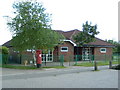
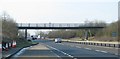
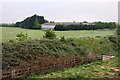
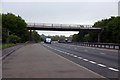
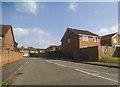
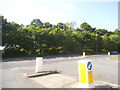
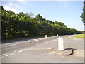
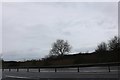

23 photos from this area
Area Information
Key information about the OX14 1YJ including its size, population, and administrative classification.
- Area Type
- Postcode
- Area Size
- 7155 m²
- Population
- 1411
- Population Density
- 5788 people/km²
House Prices in OX14 1YJ
23
Properties
£245,120
Average Sold Price
£85,000
Lowest Price
£387,500
Highest Price
Showing 23 properties
| Address | Type | Beds | Baths | Last Sale Price | Last Sale Date | |
|---|---|---|---|---|---|---|
| 35 Woodley Close, Abingdon, OX14 1YJ | Semi-detached | 2 | 1 | £300,000 | Jun 2022 | |
| 41 Woodley Close, Abingdon, OX14 1YJ | house | - | - | £385,000 | May 2022 | |
| 34 Woodley Close, Abingdon, OX14 1YJ | Terraced | 2 | 1 | £265,000 | Mar 2021 | |
| 37 Woodley Close, Abingdon, OX14 1YJ | house | - | - | £267,500 | Dec 2020 | |
| 49 Woodley Close, Abingdon, OX14 1YJ | Detached | 5 | - | £387,500 | Apr 2014 | |
| 33 Woodley Close, Abingdon, OX14 1YJ | Terraced | 2 | 1 | £202,500 | Aug 2013 | |
| 54 Woodley Close, Abingdon, OX14 1YJ | house | - | - | £305,000 | Sep 2011 | |
| 36 Woodley Close, Abingdon, OX14 1YJ | Semi-detached | 2 | 1 | £194,000 | Aug 2011 | |
| 38 Woodley Close, Abingdon, OX14 1YJ | Detached | - | - | £249,950 | Apr 2008 | |
| 46 Woodley Close, Abingdon, OX14 1YJ | Detached | - | - | £255,000 | Jun 2007 |
Page 1 of 3
Energy Efficiency in OX14 1YJ
Amenities
Schools
| Rank | School | Type | Entry gender | Ages |
|---|
Explore more schools in this area
Go to Schools tabDemographics
Household Size
Two person
most common
Accommodation Type
Houses
most common
Tenure
72
majority
Ethnic Group
White
most common
Religion
N/A
most common
Household Composition
N/A
most common
Age
47
median
Adults (30-64 years)
most common
Household Deprivation
N/A
with no deprivation
NS-SEC
52
in Lower managerial occupations
Explore more demographic insights in this area
Go to Demographics tabPlanning
Planning Constraints
- Flood RiskPremium
- Ramsar Wetland SitesPremium
- Area of Outstanding Natural BeautyPremium
- Protected Nature ReservePremium
- Protected WoodlandPremium