Area Overview for OX13 6DD
Photos of OX13 6DD
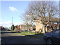
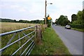
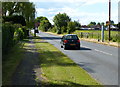
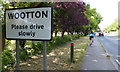
17 photos from this area
Area Information
Key information about the OX13 6DD including its size, population, and administrative classification.
- Area Type
- Postcode
- Area Size
- 22.0 hectares
- Population
- 1423
- Population Density
- 156 people/km²
House Prices in OX13 6DD
29
Properties
£424,694
Average Sold Price
£125,000
Lowest Price
£859,000
Highest Price
Showing 29 properties
| Address | Type | Beds | Baths | Last Sale Price | Last Sale Date | |
|---|---|---|---|---|---|---|
| 49 Home Close, Wootton, Abingdon, OX13 6DD | Chalet | 5 | 2 | £650,000 | Oct 2024 | |
| 51 Home Close, Wootton, Abingdon, OX13 6DD | Bungalow | 3 | 1 | £506,000 | Aug 2023 | |
| 43 Home Close, Wootton, Abingdon, OX13 6DD | Bungalow | - | - | £859,000 | Aug 2022 | |
| Glyndley, 38A Home Close, Wootton, Abingdon, OX13 6DD | house | - | - | £480,000 | Sep 2021 | |
| 69 Home Close, Wootton, Abingdon, OX13 6DD | Chalet | 3 | 3 | £512,500 | Mar 2020 | |
| 67 Home Close, Wootton, Abingdon, OX13 6DD | Bungalow | 3 | 2 | £400,000 | Mar 2020 | |
| 32 Home Close, Wootton, Abingdon, OX13 6DD | Semi-detached | 4 | 2 | £397,500 | Sep 2015 | |
| 47 Home Close, Wootton, Abingdon, OX13 6DD | Bungalow | 4 | - | £518,300 | Nov 2013 | |
| 33 Home Close, Wootton, Abingdon, OX13 6DD | Bungalow | - | - | £389,000 | Mar 2010 | |
| 45 Home Close, Wootton, Abingdon, OX13 6DD | Detached | - | - | £274,950 | Nov 2008 |
Page 1 of 3
Energy Efficiency in OX13 6DD
Amenities
Schools
| Rank | School | Type | Entry gender | Ages |
|---|
Explore more schools in this area
Go to Schools tabDemographics
Household Size
Two person
most common
Accommodation Type
Houses
most common
Tenure
84
majority
Ethnic Group
White
most common
Religion
N/A
most common
Household Composition
N/A
most common
Age
47
median
Adults (30-64 years)
most common
Household Deprivation
N/A
with no deprivation
NS-SEC
53
in Lower managerial occupations
Explore more demographic insights in this area
Go to Demographics tabPlanning
Planning Constraints
- Flood RiskPremium
- Ramsar Wetland SitesPremium
- Area of Outstanding Natural BeautyPremium
- Protected Nature ReservePremium
- Protected WoodlandPremium