Area Overview for OX13 6BQ
Photos of OX13 6BQ

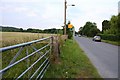
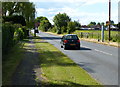
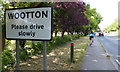
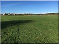
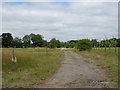
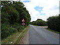
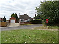
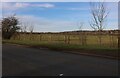
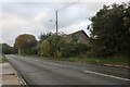
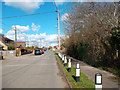
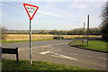
17 photos from this area
Area Information
Key information about the OX13 6BQ including its size, population, and administrative classification.
- Area Type
- Postcode
- Area Size
- 5.9 hectares
- Population
- 1379
- Population Density
- 1204 people/km²
House Prices in OX13 6BQ
27
Properties
£420,500
Average Sold Price
£139,500
Lowest Price
£810,000
Highest Price
Showing 27 properties
| Address | Type | Beds | Baths | Last Sale Price | Last Sale Date | |
|---|---|---|---|---|---|---|
| 1 The Old Pound, Wootton, Abingdon, OX13 6BQ | house | 3 | - | £680,000 | Nov 2023 | |
| Lamborough House, The Old Pound, Wootton, Abingdon, OX13 6BQ | house | - | - | £810,000 | Nov 2022 | |
| Airedale, The Old Pound, Wootton, Abingdon, OX13 6BQ | house | - | - | £698,000 | Oct 2018 | |
| 18 The Old Pound, Wootton, Abingdon, OX13 6BQ | Detached | 4 | 3 | £640,000 | Mar 2016 | |
| 20 The Old Pound, Wootton, Abingdon, OX13 6BQ | house | - | - | £480,000 | May 2012 | |
| 2 The Old Pound, Wootton, Abingdon, OX13 6BQ | house | - | - | £495,000 | Mar 2012 | |
| 19 The Old Pound, Wootton, Abingdon, OX13 6BQ | house | 5 | - | £485,000 | Nov 2011 | |
| 10 The Old Pound, Wootton, Abingdon, OX13 6BQ | Detached | - | - | £472,500 | Jun 2009 | |
| 23 The Old Pound, Wootton, Abingdon, OX13 6BQ | Detached | - | - | £139,500 | Apr 2003 | |
| 22 The Old Pound, Wootton, Abingdon, OX13 6BQ | Detached | - | - | £267,000 | Aug 2001 |
Page 1 of 3
Energy Efficiency in OX13 6BQ
Amenities
Schools
| Rank | School | Type | Entry gender | Ages |
|---|
Explore more schools in this area
Go to Schools tabDemographics
Household Size
Family (3-5 people)
most common
Accommodation Type
Houses
most common
Tenure
57
majority
Ethnic Group
White
most common
Religion
N/A
most common
Household Composition
N/A
most common
Age
47
median
Adults (30-64 years)
most common
Household Deprivation
N/A
with no deprivation
NS-SEC
33
in Lower managerial occupations
Explore more demographic insights in this area
Go to Demographics tabPlanning
Planning Constraints
- Flood RiskPremium
- Ramsar Wetland SitesPremium
- Area of Outstanding Natural BeautyPremium
- Protected Nature ReservePremium
- Protected WoodlandPremium