Area Overview for OX10 8JJ
Photos of OX10 8JJ
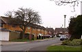
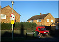
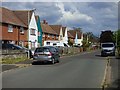
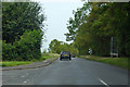
49 photos from this area
Area Information
Key information about the OX10 8JJ including its size, population, and administrative classification.
- Area Type
- Postcode
- Area Size
- 1.7 hectares
- Population
- 1413
- Population Density
- 1947 people/km²
House Prices in OX10 8JJ
12
Properties
£266,833
Average Sold Price
£183,000
Lowest Price
£445,000
Highest Price
Showing 12 properties
| Address | Type | Beds | Baths | Last Sale Price | Last Sale Date | |
|---|---|---|---|---|---|---|
| 26 Blackstone Road, Wallingford, OX10 8JJ | Semi-detached | 2 | 1 | £345,000 | Oct 2022 | |
| 36 Blackstone Road, Wallingford, OX10 8JJ | Semi-detached | 4 | 2 | £445,000 | Jun 2018 | |
| 28 Blackstone Road, Wallingford, OX10 8JJ | Semi-detached | 2 | 1 | £279,000 | Aug 2016 | |
| 16 Blackstone Road, Wallingford, OX10 8JJ | house | - | - | £282,500 | Jul 2011 | |
| 14 Blackstone Road, Wallingford, OX10 8JJ | house | - | - | £250,000 | Jun 2007 | |
| 18 Blackstone Road, Wallingford, OX10 8JJ | Semi-detached | - | - | £228,000 | Oct 2006 | |
| 20 Blackstone Road, Wallingford, OX10 8JJ | house | - | - | £194,000 | Mar 2006 | |
| 30 Blackstone Road, Wallingford, OX10 8JJ | Semi-detached | - | - | £183,000 | Jan 2004 | |
| 34 Blackstone Road, Wallingford, OX10 8JJ | house | - | - | £195,000 | Nov 2002 | |
| 22 Blackstone Road, Wallingford, OX10 8JJ | Detached | 3 | 2 | - | - |
Page 1 of 2
Energy Efficiency in OX10 8JJ
Amenities
Schools
| Rank | School | Type | Entry gender | Ages |
|---|
Explore more schools in this area
Go to Schools tabDemographics
Household Size
One person
most common
Accommodation Type
Houses
most common
Tenure
57
majority
Ethnic Group
White
most common
Religion
N/A
most common
Household Composition
N/A
most common
Age
47
median
Adults (30-64 years)
most common
Household Deprivation
N/A
with no deprivation
NS-SEC
48
in Lower managerial occupations
Explore more demographic insights in this area
Go to Demographics tabPlanning
Planning Constraints
- Flood RiskPremium
- Ramsar Wetland SitesPremium
- Area of Outstanding Natural BeautyPremium
- Protected Nature ReservePremium
- Protected WoodlandPremium