Area Overview for OX10 8HH
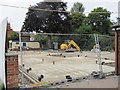
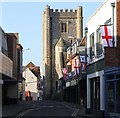
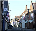
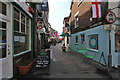
Photos of OX10 8HH


Area Information
Living in OX10 8HH offers a quiet residential experience within a compact zone measuring just 4649 square metres. This specific postcode covers a small cluster of homes where daily life revolves around proximity and community familiarity. With a population of 1353, you will find a tight-knit environment rather than a sprawling suburb. The area sits entirely within England, serving as a distinct pocket of housing close to Wallingford and other key locations. Because the footprint is so small, distances to local facilities are short, making it ideal for those who value convenience without leaving their immediate neighbourhood. The community feels established, with residents likely knowing their neighbours by sight. You are trading the anonymity of a large city for a setting where every street has a name and every house has a history. This small scale ensures that you can appreciate the locality without the noise or congestion often found in larger towns. The area is defined by its residential nature, focusing on providing homes rather than commercial activity. For a homebuyer seeking a settled location with minimal distractions, this postcode delivers exactly that environment.
- Area Type
- Postcode
- Area Size
- 4649 m²
- Population
- 1353
- Population Density
- 2586 people/km²
The property market in OX10 8HH is characterised by a strong preference for ownership rather than rental living. With 64% of residents owning their homes, the area clearly functions as an owner-occupied market rather than a hub for private tenants or landlords. This statistic implies that properties here are generally well-maintained by people with a long-term stake in the neighbourhood. The predominant accommodation type is houses, which aligns perfectly with the demographic profile of a median age of 47 years. You will find families seeking room space and private gardens rather than urban dwellers looking for high-rise flats. This makes the area a traditional choice for those buying their first home or upgrading after renting elsewhere. Homes in OX10 8HH reflect a settled lifestyle where buyers seek permanence. The concentration of house ownership means local estate agents will primarily deal with sales rather than solely lettings. When browsing properties near OX10 8HH, you should look for standard residential houses designed for everyday family life. The market stability indicated by the ownership rate suggests reliable investment potential for long-term buyers interested in this small postcode.
House Prices in OX10 8HH
No properties found in this postcode.
Energy Efficiency in OX10 8HH
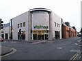
Your lifestyle in OX10 8HH will be supported by a convenient range of amenities within practical reach. For your shopping needs, there are five major retail options nearby, including Asda Rectory, Waitrose Wallingford, and Lidl Lupton Road. These supermarkets provide everything from fresh groceries to household essentials without needing a long journey. Five railway stations serve the region, with Cholsey Railway Station, Didcot Parkway Railway Station, and Appleford Railway Station all within easy access. This rail network offers frequent connections to larger cities and business hubs. You have two airport choices nearby, namely RAF Benson and Chalgrove Airport, providing flexibility for both travel and freight logistics. The nearest metro hub is Wallingford, which acts as a central transport and leisure node for the wider area. These facilities mean you do not need to drive far for daily chores or weekend trips. Living in OX10 8HH offers the best of both worlds with quiet domestic settings and easy access to commercial centres. Schools near OX10 8HH are conveniently located to support local families, though specific school names are not detailed in this summary.
Amenities
Schools
| Rank | School | Type | Entry gender | Ages |
|---|
Explore more schools in this area
Go to Schools tabDemographics
The community within OX10 8HH reflects a mature demographic profile with a median age of 47 years. Adults between the ages of 30 and 64 represent the most common age range, indicating a neighbourhood dominated by established families and professionals. Home ownership stands at a solid 64%, meaning that nearly two-thirds of the 1353 residents own their property outright. This high rate of ownership suggests stability, with fewer likely to be transient renters looking for temporary accommodation. The predominant ethnic group is White, which characterises the social fabric of this specific residential cluster. Since the primary accommodation type consists of houses rather than flats, families and those seeking detached or semi-detached living options will find this area most suitable. The population density reaches an astonishing 291045 people per square kilometre given the tiny land area, though this reflects the concentrated nature of the postal code rather than overcrowding. You can expect a population with significant life experience and financial security. The age mix ensures that local schools and community groups likely cater to families with children living near OX10 8HH.
Household Size
Accommodation Type
Tenure
Ethnic Group
Religion
Household Composition
Age
Household Deprivation
NS-SEC
Explore more demographic insights in this area
Go to Demographics tabPlanning
Planning Constraints
- Flood RiskPremium
- Ramsar Wetland SitesPremium
- Area of Outstanding Natural BeautyPremium
- Protected Nature ReservePremium
- Protected WoodlandPremium